SevereTornado★ Peak frameCaptured 2d ago
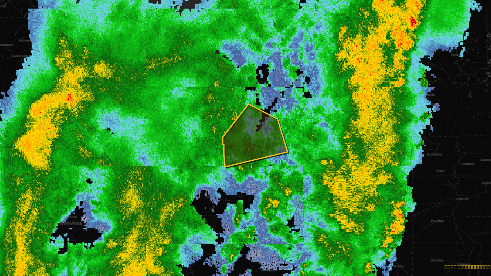
Tornado Warning issued April 18 at 12:42AM EDT until April 18 at 1:15AM EDT by NWS Northern Indiana
Indiana, Michigan
Pull this lead list →Pre-loads ~135,323 residential properties into Step 2 for zone selection.
⚠Counts inside NWS warning area· storm hadn’t entered polygon at capture
Storm Score
24
🏠 Residential
135,323
🏢 Commercial
9,827
Total properties
145,150
Estimated roofing opportunity🔴 Zones 1 & 2
💰 ~$70M
Conservative estimate at 10% claim rate, scoped to the damage zone (core + inner — ~40% of the warning polygon): 🏠 ~54,129 residential · 🏢 ~3,931 commercial. Industry-low claim values ($10K residential / $40K commercial).
Issued
Apr 18, 4:42 AM UTC
Expires
Apr 18, 5:15 AM UTC
Event type
Tornado Warning
Affected areas (4)
Elkhart, INSt. Joseph, INBerrien, MICass, MI
ID: urn:oid:2.49.0.1.840.0.8bf370b64c811c90e761b0e61113ce584b044409.001.1Centroid: 41.693, -86.297