SevereThunderstorm★ Peak frameCaptured 2d ago
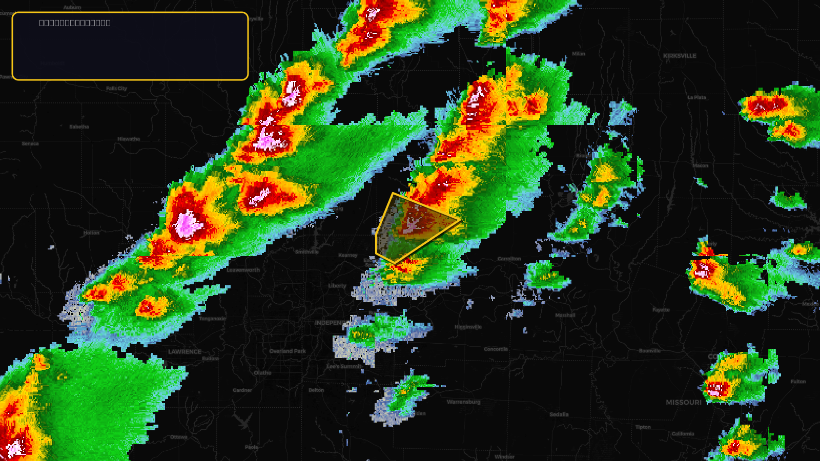
Severe Thunderstorm Warning issued April 17 at 2:40PM CDT until April 17 at 3:15PM CDT by NWS Kansas City/Pleasant Hill MO
Missouri
Pull this lead list →Pre-loads ~1,232 residential properties into Step 2 for zone selection.
✓Counts inside actual storm footprint· 12.7% of NWS polygon hit
Storm Score
20
🏠 Residential
1,232
🏢 Commercial
37
Total properties
1,269
Estimated roofing opportunity🔴 Zones 1 & 2
💰 ~$553K
Conservative estimate at 10% claim rate, scoped to the damage zone (core + inner — ~40% of the warning polygon): 🏠 ~493 residential · 🏢 ~15 commercial. Industry-low claim values ($10K residential / $40K commercial).
NWS intensity
🧊 1.25"Hail💨 60MPHRadar indicatedIntensity Score 25/100
Issued
Apr 17, 7:40 PM UTC
Expires
Apr 17, 8:15 PM UTC
Event type
Severe Thunderstorm Warning
Affected areas (2)
Caldwell, MORay, MO
ID: urn:oid:2.49.0.1.840.0.8abfd2632374ac0b731c75961d2ce46b27fa584c.001.1Centroid: 39.475, -94.028