SevereThunderstorm★ Peak frameCaptured 2d ago
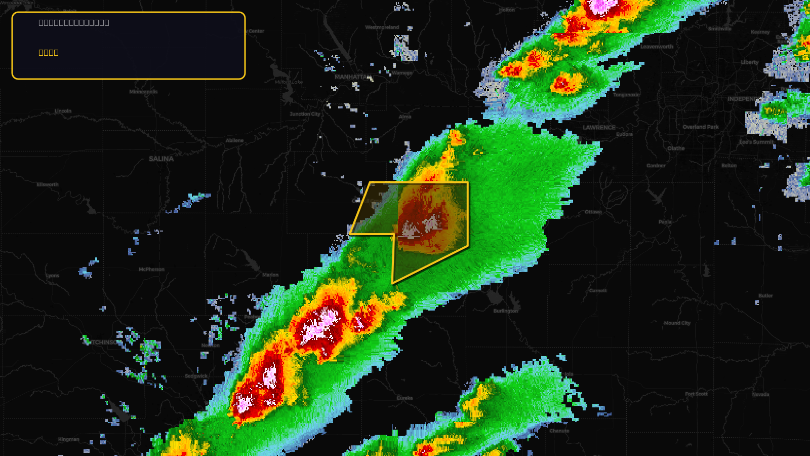
Severe Thunderstorm Warning issued April 17 at 2:30PM CDT until April 17 at 3:15PM CDT by NWS Topeka KS
Kansas
Pull this lead list →Pre-loads ~3,733 residential properties into Step 2 for zone selection.
✓Counts inside actual storm footprint· 12.8% of NWS polygon hit
Storm Score
20
🏠 Residential
3,733
🏢 Commercial
226
Total properties
3,959
Estimated roofing opportunity🔴 Zones 1 & 2
💰 ~$1.9M
Conservative estimate at 10% claim rate, scoped to the damage zone (core + inner — ~40% of the warning polygon): 🏠 ~1,493 residential · 🏢 ~90 commercial. Industry-low claim values ($10K residential / $40K commercial).
NWS intensity
🧊 1.5"Hail💨 60MPHRadar indicatedIntensity Score 34/100
Issued
Apr 17, 7:30 PM UTC
Expires
Apr 17, 8:15 PM UTC
Event type
Severe Thunderstorm Warning
Affected areas (2)
Lyon, KSMorris, KS
ID: urn:oid:2.49.0.1.840.0.82cea97b11033cc0f1a9715ad5fdbc5d12b036d2.001.1Centroid: 38.546, -96.290