Very SevereThunderstorm★ Peak frameCaptured 2d ago
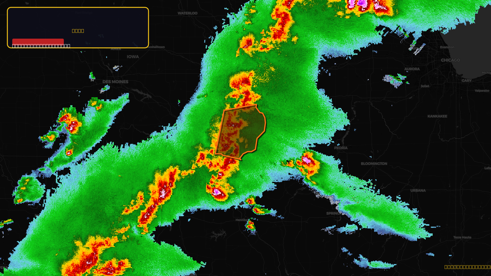
Severe Thunderstorm Warning issued April 17 at 5:27PM CDT until April 17 at 6:30PM CDT by NWS Quad Cities IA IL
Illinois, Iowa
Pull this lead list →Pre-loads ~10,397 residential properties into Step 2 for zone selection.
✓Counts inside actual storm footprint· 12.6% of NWS polygon hit
Storm Score
28
🏠 Residential
10,397
🏢 Commercial
921
Total properties
11,318
Estimated roofing opportunity🔴 Zones 1 & 2
💰 ~$12M
Conservative estimate at 22% claim rate, scoped to the damage zone (core + inner — ~40% of the warning polygon): 🏠 ~4,159 residential · 🏢 ~368 commercial. Industry-low claim values ($10K residential / $40K commercial).
NWS intensity
🧊 0.75"Hail💨 70MPHRadar indicated⚠ ConsiderableIntensity Score 28/100
Issued
Apr 17, 10:27 PM UTC
Expires
Apr 17, 11:30 PM UTC
Event type
Severe Thunderstorm Warning
Affected areas (8)
Henderson, ILDes Moines, IAHenry, IAJefferson, IALee, IALouisa, IAVan Buren, IAWashington, IA
ID: urn:oid:2.49.0.1.840.0.81be1126ddc1918f9d2664d88c735f5c9bd8f455.001.1Centroid: 40.825, -91.297