SevereThunderstorm★ Peak frameCaptured 2d ago
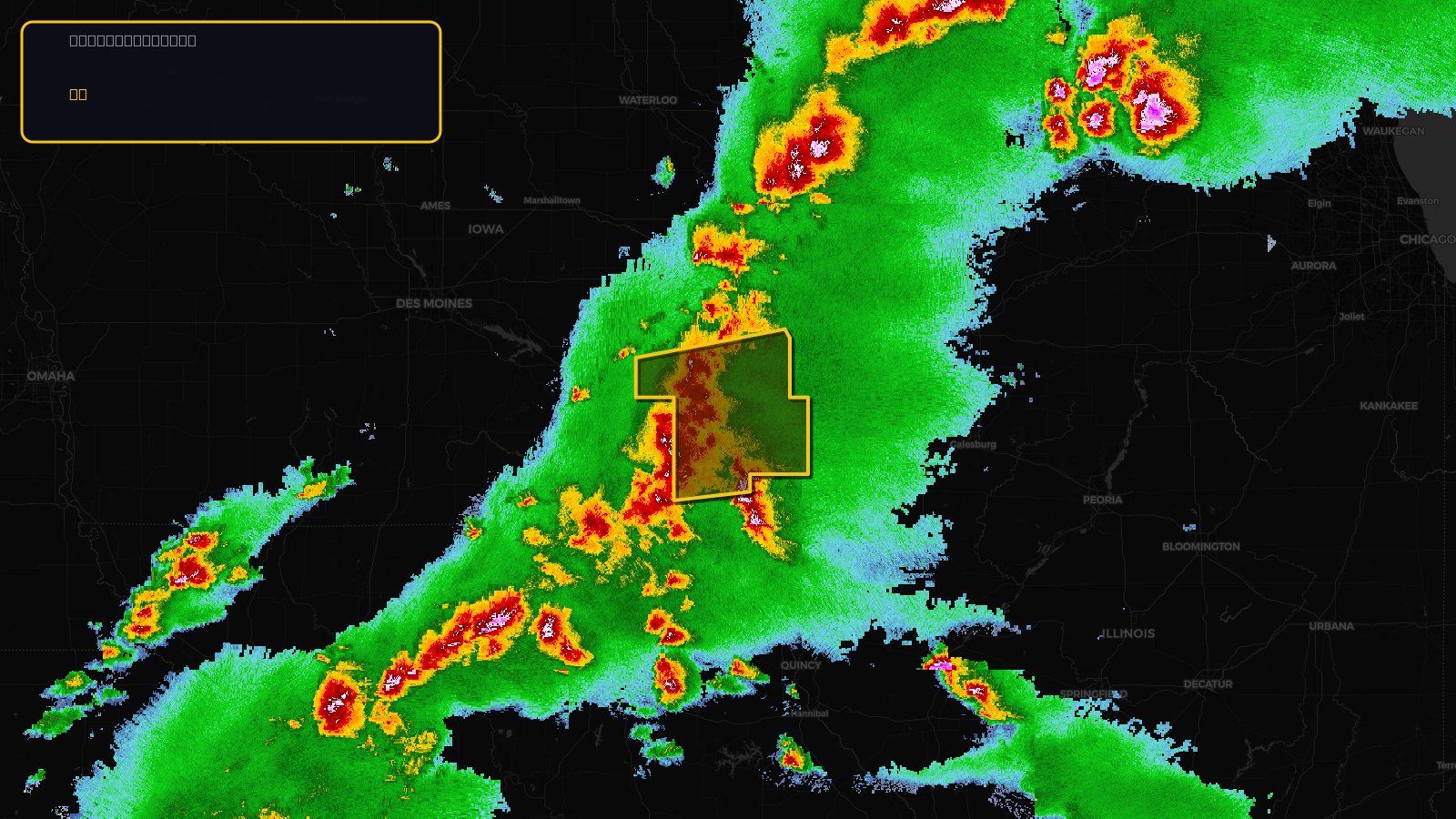
Severe Thunderstorm Warning issued April 17 at 4:13PM CDT until April 17 at 5:30PM CDT by NWS Quad Cities IA IL
Iowa
Pull this lead list →Pre-loads ~13,980 residential properties into Step 2 for zone selection.
✓Counts inside actual storm footprint· 11.7% of NWS polygon hit
Storm Score
13
🏠 Residential
13,980
🏢 Commercial
1,473
Total properties
15,453
Estimated roofing opportunity🔴 Zones 1 & 2
💰 ~$7.9M
Conservative estimate at 10% claim rate, scoped to the damage zone (core + inner — ~40% of the warning polygon): 🏠 ~5,592 residential · 🏢 ~589 commercial. Industry-low claim values ($10K residential / $40K commercial).
NWS intensity
🧊 1"Hail💨 60MPHRadar indicatedIntensity Score 13/100
Issued
Apr 17, 9:13 PM UTC
Expires
Apr 17, 10:30 PM UTC
Event type
Severe Thunderstorm Warning
Affected areas (5)
Henry, IAJefferson, IAKeokuk, IAVan Buren, IAWashington, IA
ID: urn:oid:2.49.0.1.840.0.7e91d73d7849137e824084e632e15acfb5faba87.001.1Centroid: 41.105, -91.853