SevereThunderstorm★ Peak frameCaptured 2d ago
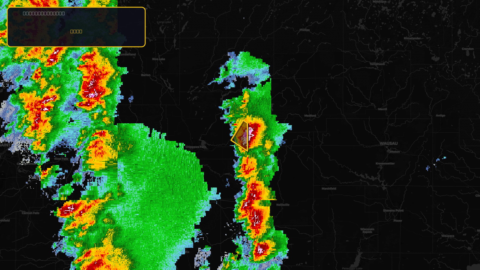
Severe Thunderstorm Warning issued April 17 at 2:35PM CDT until April 17 at 2:45PM CDT by NWS Twin Cities/Chanhassen MN
Wisconsin
Pull this lead list →Pre-loads ~1,085 residential properties into Step 2 for zone selection.
✓Counts inside actual storm footprint· 17.8% of NWS polygon hit
Storm Score
16
🏠 Residential
1,085
🏢 Commercial
154
Total properties
1,239
Estimated roofing opportunity🔴 Zones 1 & 2
💰 ~$682K
Conservative estimate at 10% claim rate, scoped to the damage zone (core + inner — ~40% of the warning polygon): 🏠 ~434 residential · 🏢 ~62 commercial. Industry-low claim values ($10K residential / $40K commercial).
NWS intensity
🧊 1.25"HailRadar indicatedIntensity Score 22/100
Issued
Apr 17, 7:35 PM UTC
Expires
Apr 17, 7:45 PM UTC
Event type
Severe Thunderstorm Warning
Affected areas (1)
Chippewa, WI
ID: urn:oid:2.49.0.1.840.0.7b4f15deef3de600eac788e2c7e4ef06acd3b33e.001.1Centroid: 45.014, -90.988