Very SevereThunderstorm★ Peak frameCaptured 2d ago
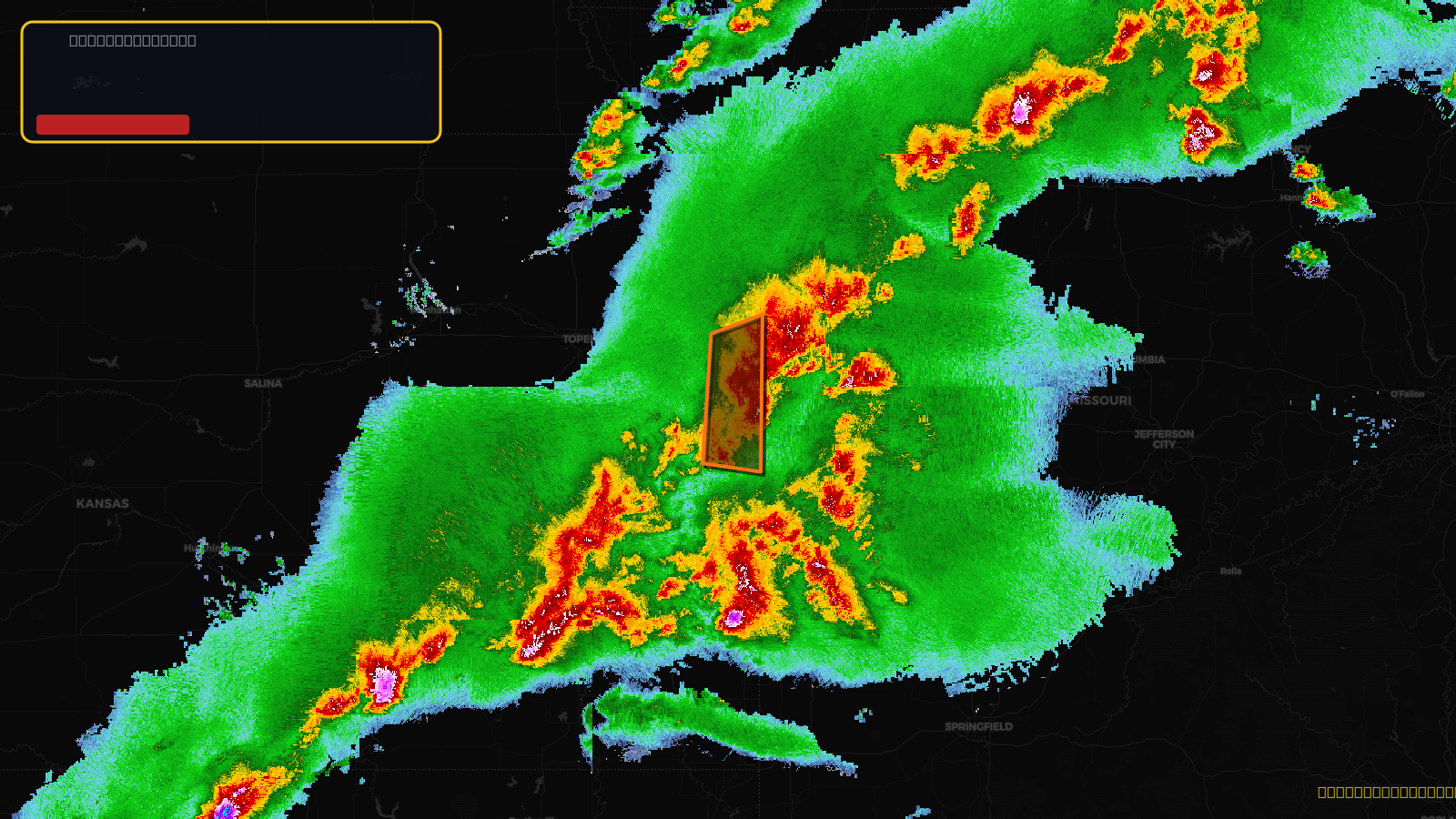
Severe Thunderstorm Warning issued April 17 at 5:17PM CDT until April 17 at 5:45PM CDT by NWS Kansas City/Pleasant Hill MO
Kansas
Pull this lead list →Pre-loads ~177,411 residential properties into Step 2 for zone selection.
✓Counts inside actual storm footprint· 20.1% of NWS polygon hit
Storm Score
29
🏠 Residential
177,411
🏢 Commercial
8,483
Total properties
185,894
Estimated roofing opportunity🔴 Zones 1 & 2
💰 ~$186M
Conservative estimate at 22% claim rate, scoped to the damage zone (core + inner — ~40% of the warning polygon): 🏠 ~70,964 residential · 🏢 ~3,393 commercial. Industry-low claim values ($10K residential / $40K commercial).
NWS intensity
🧊 0.88"Hail💨 70MPHRadar indicated✓ Wind observed⚠ ConsiderableIntensity Score 29/100
Issued
Apr 17, 10:17 PM UTC
Expires
Apr 17, 10:45 PM UTC
Event type
Severe Thunderstorm Warning
Affected areas (3)
Johnson, KSMiami, KSWyandotte, KS
ID: urn:oid:2.49.0.1.840.0.781adcd861687e0bb8f814a08381ffb721babd99.001.1Centroid: 38.714, -94.808