SevereThunderstorm★ Peak frameCaptured 2d ago
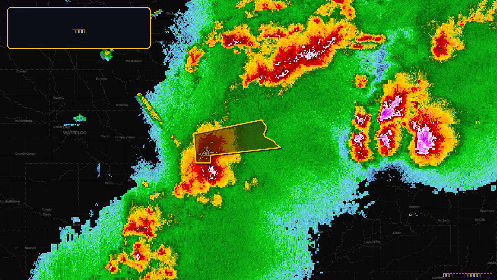
Severe Thunderstorm Warning issued April 17 at 4:53PM CDT until April 17 at 6:00PM CDT by NWS Quad Cities IA IL
Iowa
Pull this lead list →Pre-loads ~3,820 residential properties into Step 2 for zone selection.
✓Counts inside actual storm footprint· 14.7% of NWS polygon hit
Storm Score
15
🏠 Residential
3,820
🏢 Commercial
541
Total properties
4,361
Estimated roofing opportunity🔴 Zones 1 & 2
💰 ~$2.4M
Conservative estimate at 10% claim rate, scoped to the damage zone (core + inner — ~40% of the warning polygon): 🏠 ~1,528 residential · 🏢 ~216 commercial. Industry-low claim values ($10K residential / $40K commercial).
NWS intensity
🧊 1.25"Hail💨 60MPHRadar indicatedIntensity Score 15/100
Issued
Apr 17, 9:53 PM UTC
Expires
Apr 17, 11:00 PM UTC
Event type
Severe Thunderstorm Warning
Affected areas (2)
Delaware, IADubuque, IA
ID: urn:oid:2.49.0.1.840.0.76a490d9b3680a2ea4d75d044712e5d51c522568.001.1Centroid: 42.449, -90.795