WatchThunderstorm★ Peak frameCaptured 2d ago
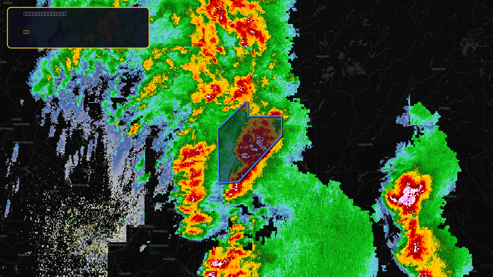
Severe Thunderstorm Warning issued April 17 at 2:34PM CDT until April 17 at 3:15PM CDT by NWS Twin Cities/Chanhassen MN
Wisconsin
Pull this lead list →Pre-loads ~12,471 residential properties into Step 2 for zone selection.
✓Counts inside actual storm footprint· 16.1% of NWS polygon hit
Storm Score
9
🏠 Residential
12,471
🏢 Commercial
718
Total properties
13,189
NWS intensity
🧊 1"HailRadar indicatedIntensity Score 10/100
Issued
Apr 17, 7:34 PM UTC
Expires
Apr 17, 8:15 PM UTC
Event type
Severe Thunderstorm Warning
Affected areas (2)
Barron, WIPolk, WI
ID: urn:oid:2.49.0.1.840.0.759b2fc4e9c8a91d011b589d0550210d0ffe77fd.001.1Centroid: 45.500, -92.162