Very SevereThunderstorm★ Peak frameCaptured 2d ago
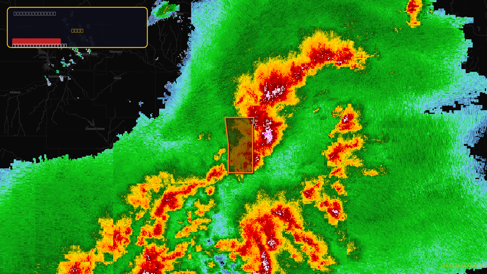
Severe Thunderstorm Warning issued April 17 at 4:42PM CDT until April 17 at 5:15PM CDT by NWS Topeka KS
Kansas
Pull this lead list →Pre-loads ~2,253 residential properties into Step 2 for zone selection.
✓Counts inside actual storm footprint· 10.4% of NWS polygon hit
Storm Score
52
🏠 Residential
2,253
🏢 Commercial
117
Total properties
2,370
Estimated roofing opportunity🔴 Zones 1 & 2
💰 ~$2.4M
Conservative estimate at 22% claim rate, scoped to the damage zone (core + inner — ~40% of the warning polygon): 🏠 ~901 residential · 🏢 ~47 commercial. Industry-low claim values ($10K residential / $40K commercial).
NWS intensity
🧊 1.25"Hail💨 80MPHRadar indicated⚠ DestructiveIntensity Score 52/100
Issued
Apr 17, 9:42 PM UTC
Expires
Apr 17, 10:15 PM UTC
Event type
Severe Thunderstorm Warning
Affected areas (2)
Anderson, KSFranklin, KS
ID: urn:oid:2.49.0.1.840.0.72d5da56d32d5822b1778111317255137ce73c26.001.1Centroid: 38.602, -95.153