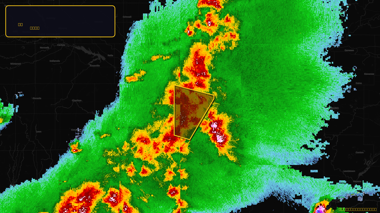
SevereTornado★ Peak frameCaptured 2d ago
Tornado Warning issued April 17 at 4:27PM CDT until April 17 at 5:15PM CDT by NWS Quad Cities IA IL
Iowa
Pull this lead list →Pre-loads ~7,713 residential properties into Step 2 for zone selection.
✓Counts inside actual storm footprint· 27.3% of NWS polygon hit
Storm Score
25
🏠 Residential
7,713
🏢 Commercial
846
Total properties
8,559
Estimated roofing opportunity🔴 Zones 1 & 2
💰 ~$4.4M
Conservative estimate at 10% claim rate, scoped to the damage zone (core + inner — ~40% of the warning polygon): 🏠 ~3,085 residential · 🏢 ~338 commercial. Industry-low claim values ($10K residential / $40K commercial).
NWS intensity
🧊 1"HailIntensity Score 25/100
Issued
Apr 17, 9:27 PM UTC
Expires
Apr 17, 10:15 PM UTC
Event type
Tornado Warning
Affected areas (2)
Jefferson, IAVan Buren, IA
ID: urn:oid:2.49.0.1.840.0.6b648ccb7f107ad65f670eeaf67cd4a8db3c6bd3.001.1Centroid: 40.962, -91.997