SevereThunderstorm★ Peak frameCaptured 2d ago
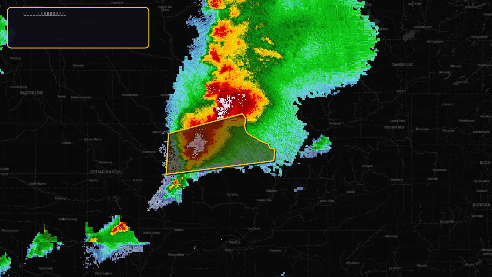
Severe Thunderstorm Warning issued April 17 at 1:56PM CDT until April 17 at 3:00PM CDT by NWS Quad Cities IA IL
Iowa
Pull this lead list →Pre-loads ~10,383 residential properties into Step 2 for zone selection.
Storm Score
13
🏠 Residential
10,383
🏢 Commercial
1,037
Total properties
11,420
Estimated roofing opportunity🔴 Zones 1 & 2
💰 ~$5.8M
Conservative estimate at 10% claim rate, scoped to the damage zone (core + inner — ~40% of the warning polygon): 🏠 ~4,153 residential · 🏢 ~415 commercial. Industry-low claim values ($10K residential / $40K commercial).
NWS intensity
🧊 1"Hail💨 60MPHRadar indicatedIntensity Score 13/100
Issued
Apr 17, 6:56 PM UTC
Expires
Apr 17, 8:00 PM UTC
Event type
Severe Thunderstorm Warning
Affected areas (4)
Clinton, IADubuque, IAJackson, IAJones, IA
ID: urn:oid:2.49.0.1.840.0.6a0ac9416ed491387b5116edece9e51240b0f807.001.1Centroid: 42.197, -90.418