SevereThunderstorm★ Peak frameCaptured 2d ago
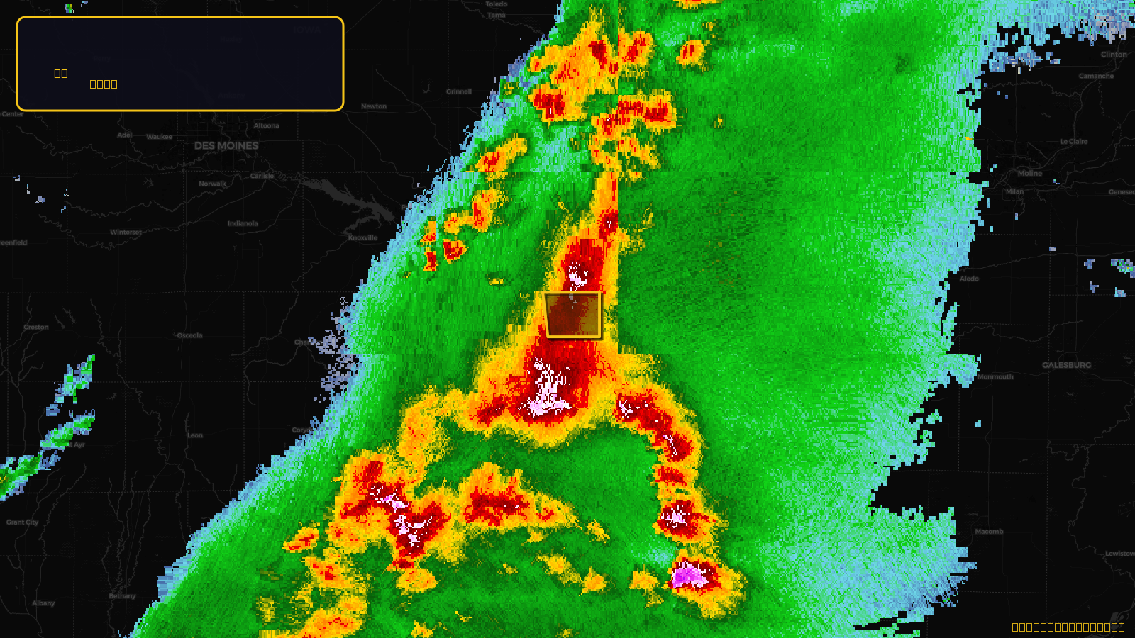
Severe Thunderstorm Warning issued April 17 at 4:26PM CDT until April 17 at 4:45PM CDT by NWS Des Moines IA
Iowa
Pull this lead list →Pre-loads ~377 residential properties into Step 2 for zone selection.
✓Counts inside actual storm footprint· 40.7% of NWS polygon hit
Storm Score
13
🏠 Residential
377
🏢 Commercial
7
Total properties
384
Estimated roofing opportunity🔴 Zones 1 & 2
💰 ~$163K
Conservative estimate at 10% claim rate, scoped to the damage zone (core + inner — ~40% of the warning polygon): 🏠 ~151 residential · 🏢 ~3 commercial. Industry-low claim values ($10K residential / $40K commercial).
NWS intensity
🧊 1"Hail💨 60MPHRadar indicatedIntensity Score 13/100
Issued
Apr 17, 9:26 PM UTC
Expires
Apr 17, 9:45 PM UTC
Event type
Severe Thunderstorm Warning
Affected areas (1)
Wapello, IA
ID: urn:oid:2.49.0.1.840.0.67fd031a516d981842d9e1aeb6762e5702fc340d.001.1Centroid: 41.082, -92.304