SevereThunderstorm★ Peak frameCaptured 2d ago
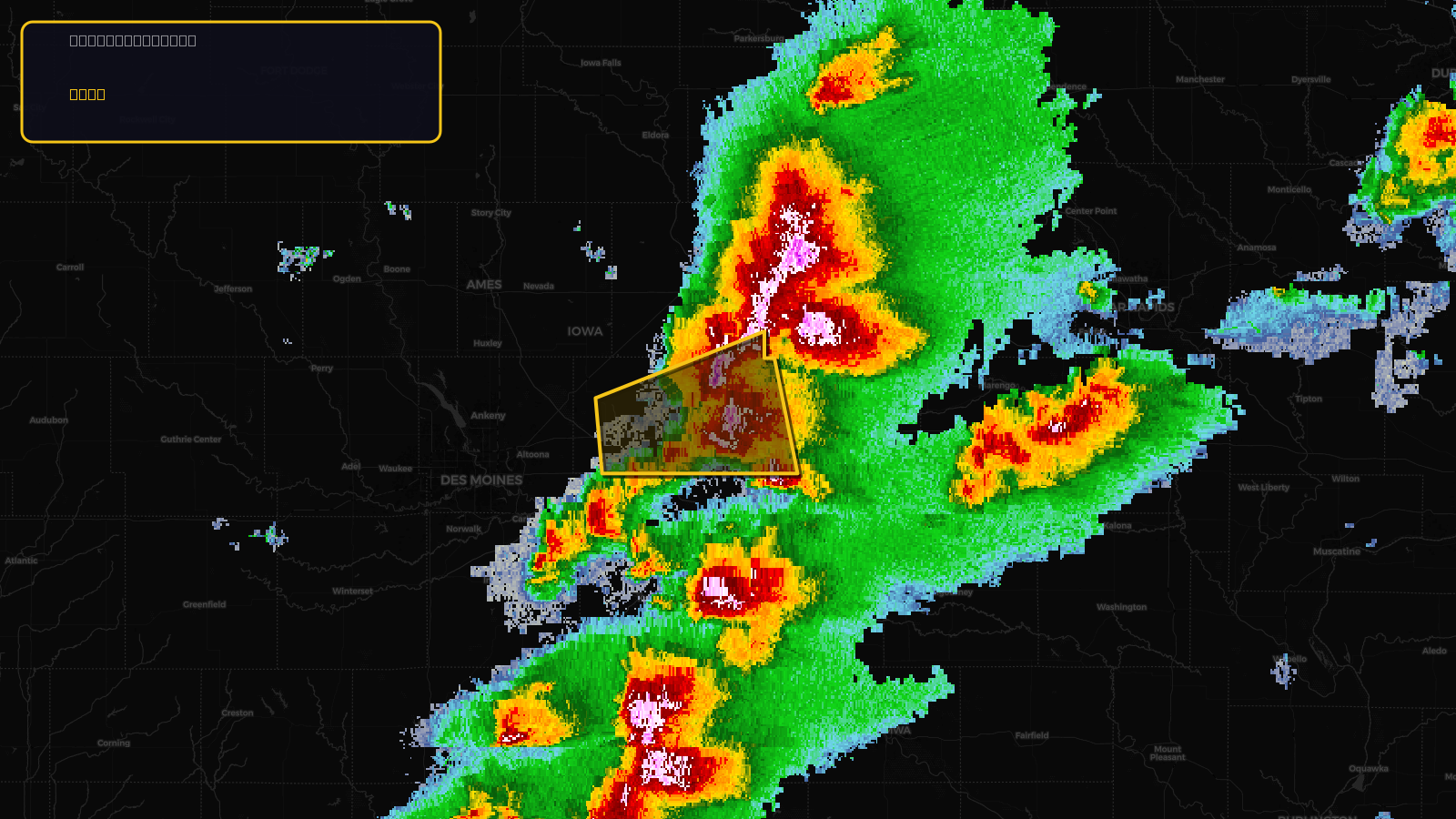
Severe Thunderstorm Warning issued April 17 at 2:44PM CDT until April 17 at 3:15PM CDT by NWS Des Moines IA
Iowa
Pull this lead list →Pre-loads ~11,995 residential properties into Step 2 for zone selection.
✓Counts inside actual storm footprint· 16% of NWS polygon hit
Storm Score
20
🏠 Residential
11,995
🏢 Commercial
1,121
Total properties
13,116
Estimated roofing opportunity🔴 Zones 1 & 2
💰 ~$6.6M
Conservative estimate at 10% claim rate, scoped to the damage zone (core + inner — ~40% of the warning polygon): 🏠 ~4,798 residential · 🏢 ~448 commercial. Industry-low claim values ($10K residential / $40K commercial).
NWS intensity
🧊 1.5"Hail💨 60MPHRadar indicatedIntensity Score 34/100
Issued
Apr 17, 7:44 PM UTC
Expires
Apr 17, 8:15 PM UTC
Event type
Severe Thunderstorm Warning
Affected areas (3)
Jasper, IAMarshall, IAPoweshiek, IA
ID: urn:oid:2.49.0.1.840.0.618bb09efe7b8b392af4830f8fd2dde6e22ddeda.001.1Centroid: 41.744, -92.880