ExtremeThunderstorm★ Peak frameCaptured 2d ago
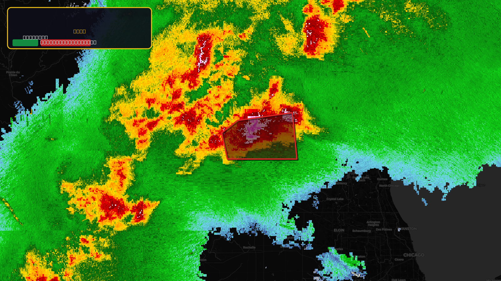
Severe Thunderstorm Warning issued April 17 at 5:33PM CDT until April 17 at 6:15PM CDT by NWS Milwaukee/Sullivan WI
Wisconsin
Pull this lead list →Pre-loads ~41,104 residential properties into Step 2 for zone selection.
✓Counts inside actual storm footprint· 21.5% of NWS polygon hit
Storm Score
74
🏠 Residential
41,104
🏢 Commercial
2,752
Total properties
43,856
Estimated roofing opportunity🔴 Zones 1 & 2
💰 ~$73M
Conservative estimate at 35% claim rate, scoped to the damage zone (core + inner — ~40% of the warning polygon): 🏠 ~16,442 residential · 🏢 ~1,101 commercial. Industry-low claim values ($10K residential / $40K commercial).
NWS intensity
🧊 2.75"Hail💨 60MPH✓ Observed (ground-truth)⚠ DestructiveIntensity Score 74/100
Issued
Apr 17, 10:33 PM UTC
Expires
Apr 17, 11:15 PM UTC
Event type
Severe Thunderstorm Warning
Affected areas (2)
Rock, WIWalworth, WI
ID: urn:oid:2.49.0.1.840.0.5c563e61b2a5ef6b163ac8bbee79b385f42551f2.001.1Centroid: 42.620, -89.057