SevereThunderstorm★ Peak frameCaptured 2d ago
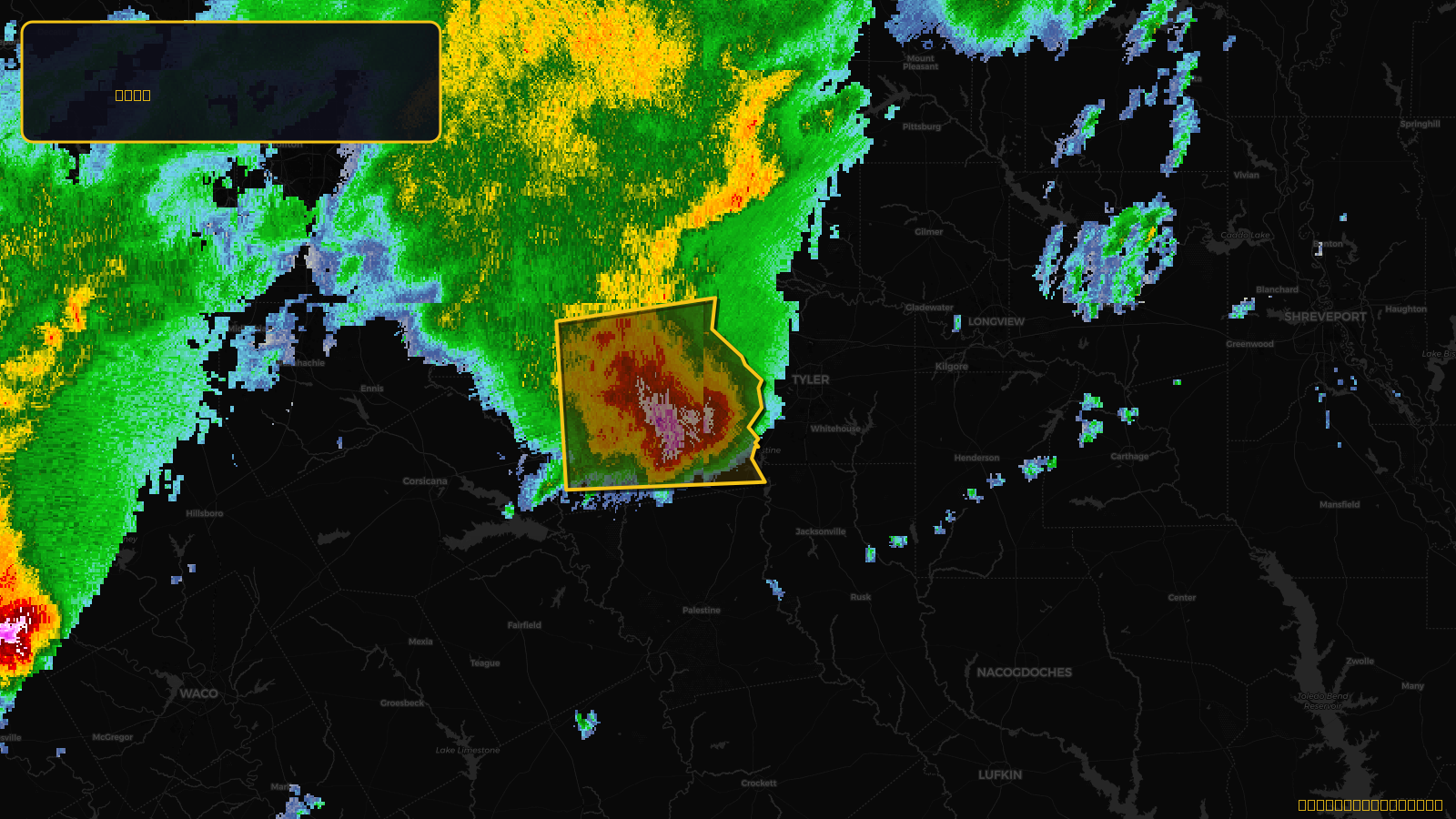
Severe Thunderstorm Warning issued April 18 at 9:53AM CDT until April 18 at 10:30AM CDT by NWS Fort Worth TX
Texas
Pull this lead list →Pre-loads ~12,958 residential properties into Step 2 for zone selection.
✓Counts inside actual storm footprint· 12.8% of NWS polygon hit
Storm Score
11
🏠 Residential
12,958
🏢 Commercial
848
Total properties
13,806
Estimated roofing opportunity🔴 Zones 1 & 2
💰 ~$6.5M
Conservative estimate at 10% claim rate, scoped to the damage zone (core + inner — ~40% of the warning polygon): 🏠 ~5,183 residential · 🏢 ~339 commercial. Industry-low claim values ($10K residential / $40K commercial).
NWS intensity
🧊 1"Hail💨 60MPHRadar indicatedIntensity Score 11/100
Issued
Apr 18, 2:53 PM UTC
Expires
Apr 18, 3:30 PM UTC
Event type
Severe Thunderstorm Warning
Affected areas (2)
Henderson, TXVan Zandt, TX
ID: urn:oid:2.49.0.1.840.0.5c029e7680b9514d06fb2a17ecbca9a7b182a59d.001.1Centroid: 32.275, -95.552