SevereThunderstorm★ Peak frameCaptured 2d ago
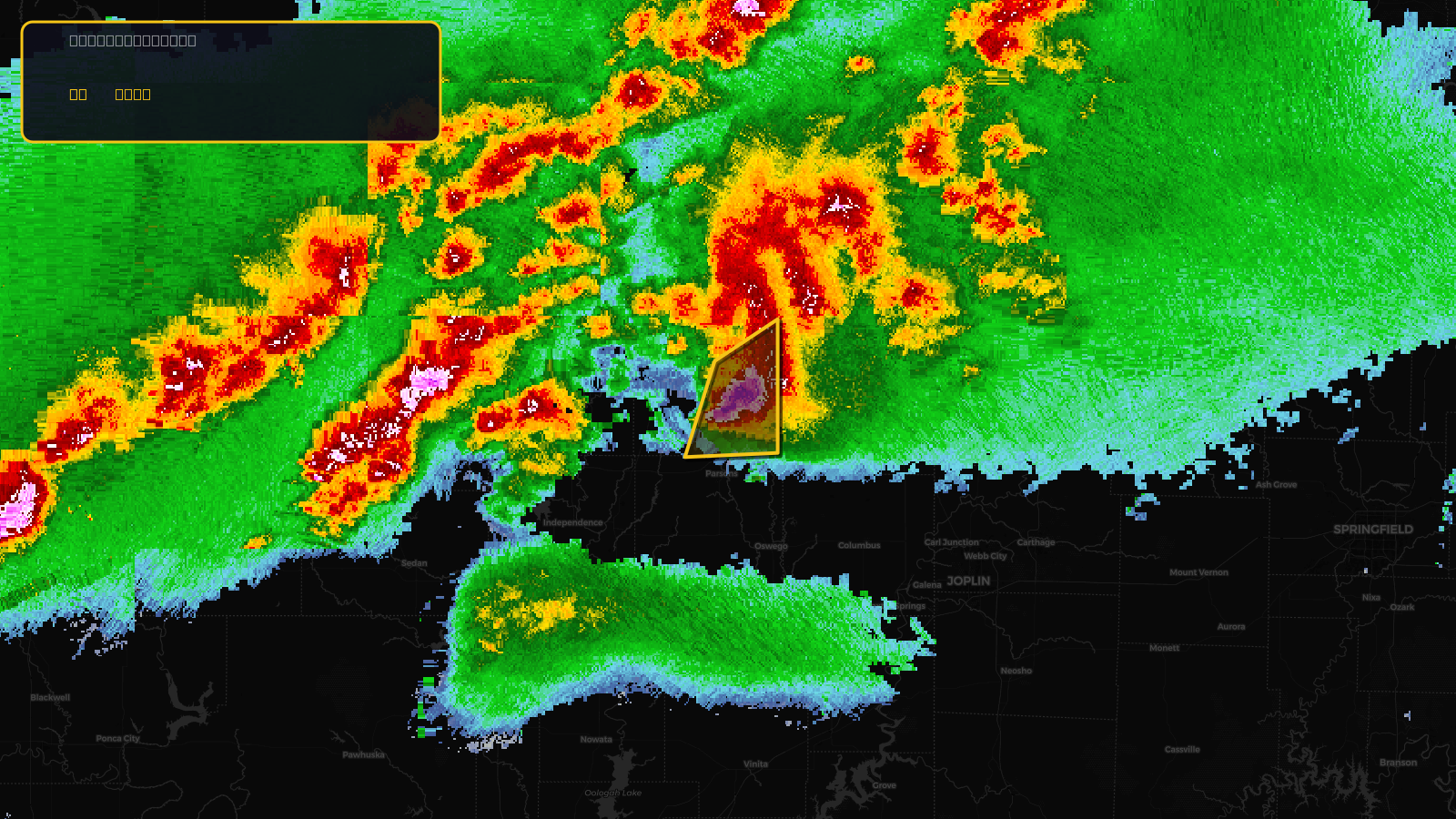
Severe Thunderstorm Warning issued April 17 at 4:32PM CDT until April 17 at 5:15PM CDT by NWS Wichita KS
Kansas
Pull this lead list →Pre-loads ~1,462 residential properties into Step 2 for zone selection.
✓Counts inside actual storm footprint· 27.8% of NWS polygon hit
Storm Score
13
🏠 Residential
1,462
🏢 Commercial
161
Total properties
1,623
Estimated roofing opportunity🔴 Zones 1 & 2
💰 ~$841K
Conservative estimate at 10% claim rate, scoped to the damage zone (core + inner — ~40% of the warning polygon): 🏠 ~585 residential · 🏢 ~64 commercial. Industry-low claim values ($10K residential / $40K commercial).
NWS intensity
🧊 1"Hail💨 60MPHRadar indicatedIntensity Score 13/100
Issued
Apr 17, 9:32 PM UTC
Expires
Apr 17, 10:15 PM UTC
Event type
Severe Thunderstorm Warning
Affected areas (1)
Neosho, KS
ID: urn:oid:2.49.0.1.840.0.5b01fb25c89de47d7fde7104a598fc1b9634fa31.001.1Centroid: 37.494, -95.240