SevereThunderstorm★ Peak frameCaptured 2d ago
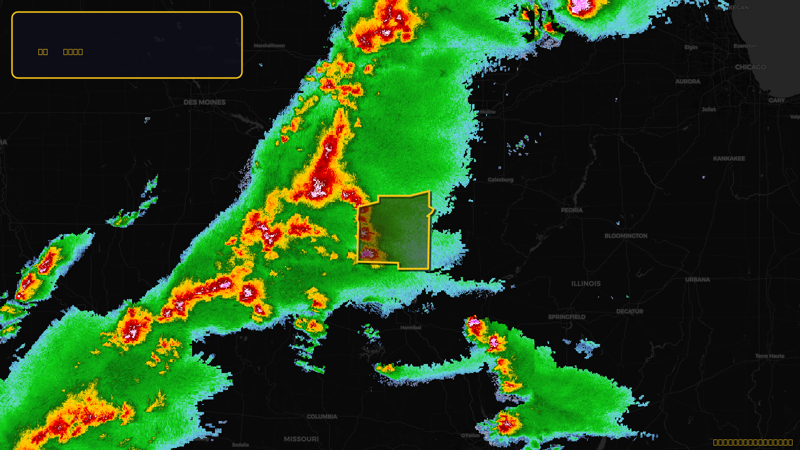
Severe Thunderstorm Warning issued April 17 at 4:23PM CDT until April 17 at 5:30PM CDT by NWS Quad Cities IA IL
Illinois, Iowa, Missouri
Pull this lead list →Pre-loads ~762 residential properties into Step 2 for zone selection.
✓Counts inside actual storm footprint· 4.6% of NWS polygon hit
Storm Score
13
🏠 Residential
762
🏢 Commercial
19
Total properties
781
Estimated roofing opportunity🔴 Zones 1 & 2
💰 ~$337K
Conservative estimate at 10% claim rate, scoped to the damage zone (core + inner — ~40% of the warning polygon): 🏠 ~305 residential · 🏢 ~8 commercial. Industry-low claim values ($10K residential / $40K commercial).
NWS intensity
🧊 1"Hail💨 60MPHRadar indicatedIntensity Score 13/100
Issued
Apr 17, 9:23 PM UTC
Expires
Apr 17, 10:30 PM UTC
Event type
Severe Thunderstorm Warning
Affected areas (5)
Hancock, ILDes Moines, IALee, IAVan Buren, IAClark, MO
ID: urn:oid:2.49.0.1.840.0.5216cb179acd0737c68a7e23a666947d309cd6ac.001.1Centroid: 40.566, -91.480