SevereThunderstorm★ Peak frameCaptured 2d ago
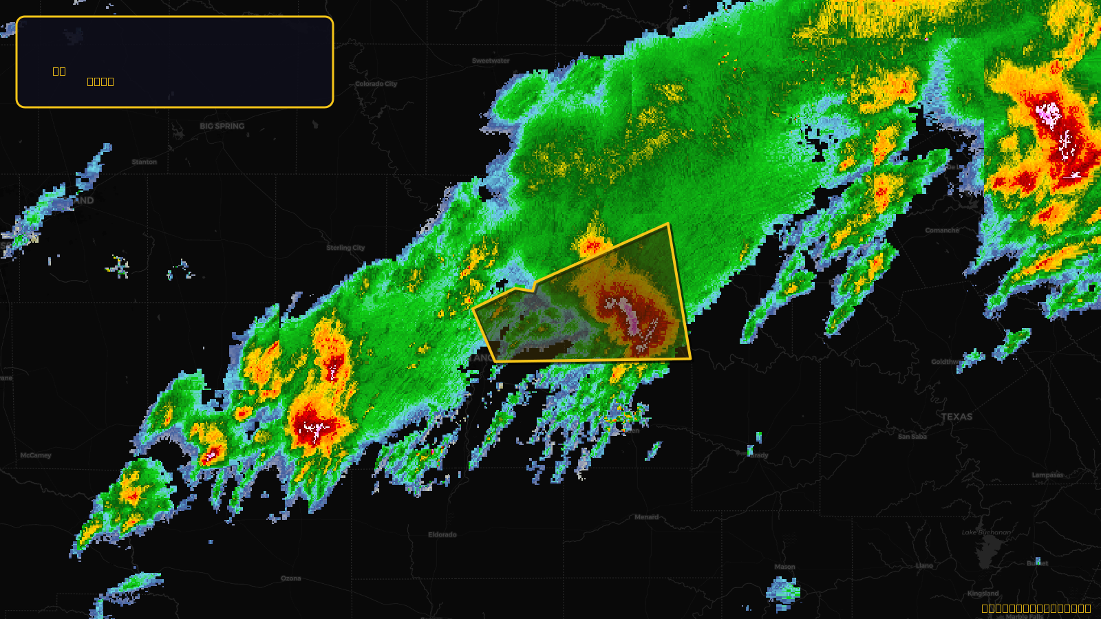
Severe Thunderstorm Warning issued April 18 at 7:40AM CDT until April 18 at 8:30AM CDT by NWS San Angelo TX
Texas
Pull this lead list →Pre-loads ~1,105 residential properties into Step 2 for zone selection.
✓Counts inside actual storm footprint· 7.7% of NWS polygon hit
Storm Score
11
🏠 Residential
1,105
🏢 Commercial
272
Total properties
1,377
Estimated roofing opportunity🔴 Zones 1 & 2
💰 ~$878K
Conservative estimate at 10% claim rate, scoped to the damage zone (core + inner — ~40% of the warning polygon): 🏠 ~442 residential · 🏢 ~109 commercial. Industry-low claim values ($10K residential / $40K commercial).
NWS intensity
🧊 1"Hail💨 60MPHRadar indicatedIntensity Score 11/100
Issued
Apr 18, 12:40 PM UTC
Expires
Apr 18, 1:30 PM UTC
Event type
Severe Thunderstorm Warning
Affected areas (4)
Coleman, TXConcho, TXRunnels, TXTom Green, TX
ID: urn:oid:2.49.0.1.840.0.5211422ea01d16fefdd023a546dd29fbd97ae833.001.1Centroid: 31.628, -100.169