SevereTornado★ Peak frameCaptured 2d ago
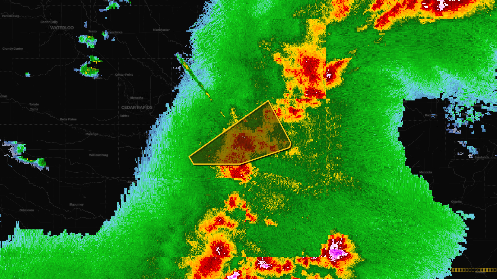
Tornado Warning issued April 17 at 5:43PM CDT until April 17 at 6:45PM CDT by NWS Quad Cities IA IL
Iowa
Pull this lead list →Pre-loads ~10,378 residential properties into Step 2 for zone selection.
✓Counts inside actual storm footprint· 11.1% of NWS polygon hit
Storm Score
24
🏠 Residential
10,378
🏢 Commercial
812
Total properties
11,190
Estimated roofing opportunity🔴 Zones 1 & 2
💰 ~$5.5M
Conservative estimate at 10% claim rate, scoped to the damage zone (core + inner — ~40% of the warning polygon): 🏠 ~4,151 residential · 🏢 ~325 commercial. Industry-low claim values ($10K residential / $40K commercial).
Issued
Apr 17, 10:43 PM UTC
Expires
Apr 17, 11:45 PM UTC
Event type
Tornado Warning
Affected areas (3)
Cedar, IAClinton, IAScott, IA
ID: urn:oid:2.49.0.1.840.0.50c5389ad27a3a9d4e04f6ef87a788a030fc7e82.001.1Centroid: 41.763, -90.684