Very SevereThunderstorm★ Peak frameCaptured 2d ago
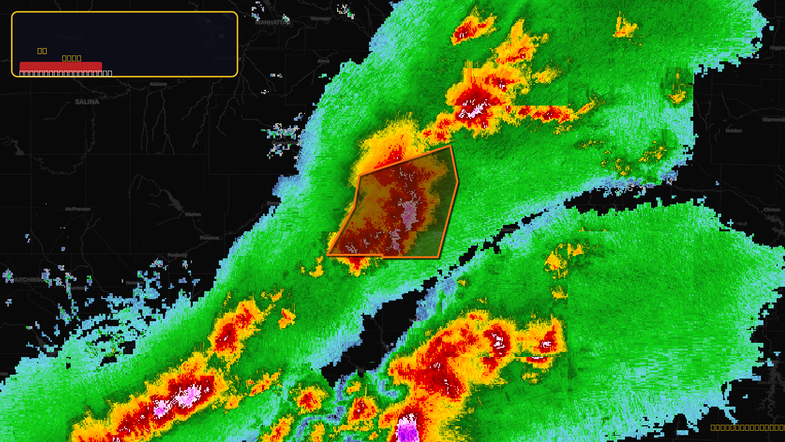
Severe Thunderstorm Warning issued April 17 at 3:52PM CDT until April 17 at 4:15PM CDT by NWS Topeka KS
Kansas
Pull this lead list →Pre-loads ~2,947 residential properties into Step 2 for zone selection.
✓Counts inside actual storm footprint· 22% of NWS polygon hit
Storm Score
46
🏠 Residential
2,947
🏢 Commercial
161
Total properties
3,108
Estimated roofing opportunity🔴 Zones 1 & 2
💰 ~$3.2M
Conservative estimate at 22% claim rate, scoped to the damage zone (core + inner — ~40% of the warning polygon): 🏠 ~1,179 residential · 🏢 ~64 commercial. Industry-low claim values ($10K residential / $40K commercial).
NWS intensity
🧊 1"Hail💨 70MPHRadar indicated⚠ ConsiderableIntensity Score 24/100
Issued
Apr 17, 8:52 PM UTC
Expires
Apr 17, 9:15 PM UTC
Event type
Severe Thunderstorm Warning
Affected areas (3)
Coffey, KSLyon, KSOsage, KS
ID: urn:oid:2.49.0.1.840.0.4e6a1450ca2b789645b6e43e4b0859febff58c00.001.1Centroid: 38.319, -95.903