SevereThunderstorm★ Peak frameCaptured 2d ago
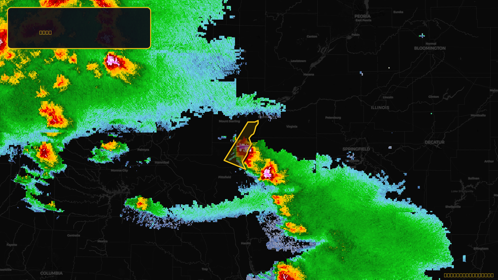
Severe Thunderstorm Warning issued April 17 at 4:22PM CDT until April 17 at 5:00PM CDT by NWS St Louis MO
Illinois
Pull this lead list →Pre-loads ~223 residential properties into Step 2 for zone selection.
✓Counts inside actual storm footprint· 13.1% of NWS polygon hit
Storm Score
13
🏠 Residential
223
🏢 Commercial
5
Total properties
228
Estimated roofing opportunity🔴 Zones 1 & 2
💰 ~$97K
Conservative estimate at 10% claim rate, scoped to the damage zone (core + inner — ~40% of the warning polygon): 🏠 ~89 residential · 🏢 ~2 commercial. Industry-low claim values ($10K residential / $40K commercial).
NWS intensity
🧊 1"Hail💨 60MPHRadar indicatedIntensity Score 13/100
Issued
Apr 17, 9:22 PM UTC
Expires
Apr 17, 10:00 PM UTC
Event type
Severe Thunderstorm Warning
Affected areas (2)
Brown, ILPike, IL
ID: urn:oid:2.49.0.1.840.0.4da13cda889489e510c89511809a2bf5746604cf.001.1Centroid: 39.858, -90.591