SevereThunderstorm★ Peak frameCaptured 2d ago
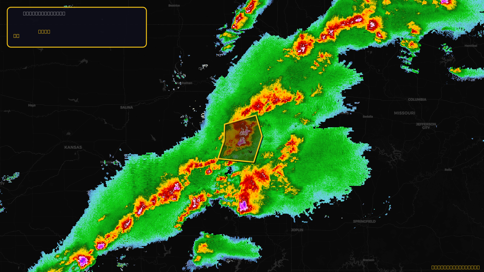
Severe Thunderstorm Warning issued April 17 at 4:12PM CDT until April 17 at 4:45PM CDT by NWS Topeka KS
Kansas
Pull this lead list →Pre-loads ~6,654 residential properties into Step 2 for zone selection.
✓Counts inside actual storm footprint· 10.5% of NWS polygon hit
Storm Score
13
🏠 Residential
6,654
🏢 Commercial
469
Total properties
7,123
Estimated roofing opportunity🔴 Zones 1 & 2
💰 ~$3.4M
Conservative estimate at 10% claim rate, scoped to the damage zone (core + inner — ~40% of the warning polygon): 🏠 ~2,662 residential · 🏢 ~188 commercial. Industry-low claim values ($10K residential / $40K commercial).
NWS intensity
🧊 1"Hail💨 60MPHRadar indicatedIntensity Score 13/100
Issued
Apr 17, 9:12 PM UTC
Expires
Apr 17, 9:45 PM UTC
Event type
Severe Thunderstorm Warning
Affected areas (4)
Anderson, KSCoffey, KSFranklin, KSOsage, KS
ID: urn:oid:2.49.0.1.840.0.490943c27b452496fa93a39db9600fd314369429.001.1Centroid: 38.433, -95.513