Very SevereTornado★ Peak frameCaptured 2d ago
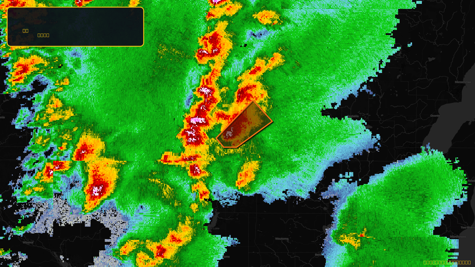
Tornado Warning issued April 17 at 4:21PM CDT until April 17 at 5:00PM CDT by NWS Green Bay WI
Wisconsin
Pull this lead list →Pre-loads ~12,640 residential properties into Step 2 for zone selection.
✓Counts inside actual storm footprint· 19.4% of NWS polygon hit
Storm Score
30
🏠 Residential
12,640
🏢 Commercial
898
Total properties
13,538
Estimated roofing opportunity🔴 Zones 1 & 2
💰 ~$14M
Conservative estimate at 22% claim rate, scoped to the damage zone (core + inner — ~40% of the warning polygon): 🏠 ~5,056 residential · 🏢 ~359 commercial. Industry-low claim values ($10K residential / $40K commercial).
NWS intensity
🧊 1"HailIntensity Score 10/100
Issued
Apr 17, 9:21 PM UTC
Expires
Apr 17, 10:00 PM UTC
Event type
Tornado Warning
Affected areas (1)
Marathon, WI
ID: urn:oid:2.49.0.1.840.0.473b9f39912d925ae12bc831c32af7f4c4ebca94.001.1Centroid: 44.770, -89.702