Very SevereTornado★ Peak frameCaptured 2d ago
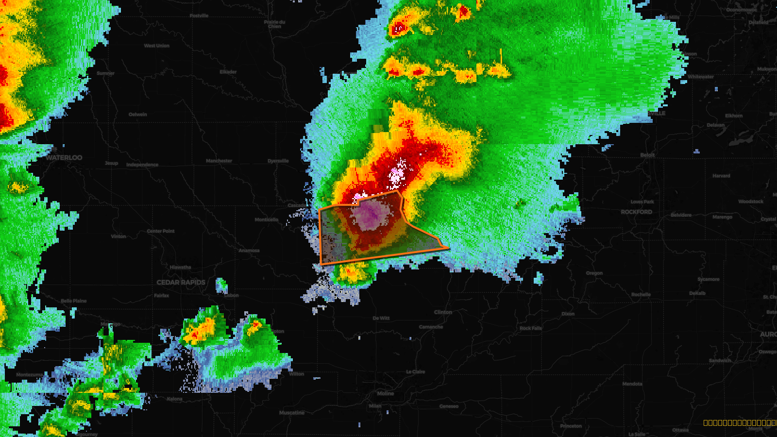
Tornado Warning issued April 17 at 2:14PM CDT until April 17 at 3:15PM CDT by NWS Quad Cities IA IL
Iowa
Pull this lead list →Pre-loads ~3,333 residential properties into Step 2 for zone selection.
✓Counts inside actual storm footprint· 16.1% of NWS polygon hit
Storm Score
30
🏠 Residential
3,333
🏢 Commercial
180
Total properties
3,513
Estimated roofing opportunity🔴 Zones 1 & 2
💰 ~$3.6M
Conservative estimate at 22% claim rate, scoped to the damage zone (core + inner — ~40% of the warning polygon): 🏠 ~1,333 residential · 🏢 ~72 commercial. Industry-low claim values ($10K residential / $40K commercial).
Issued
Apr 17, 7:14 PM UTC
Expires
Apr 17, 8:15 PM UTC
Event type
Tornado Warning
Affected areas (1)
Jackson, IA
ID: urn:oid:2.49.0.1.840.0.4693e04e93aef8450b810d4ae82ce743add05e69.001.1Centroid: 42.243, -90.498