Very SevereThunderstorm★ Peak frameCaptured 2d ago
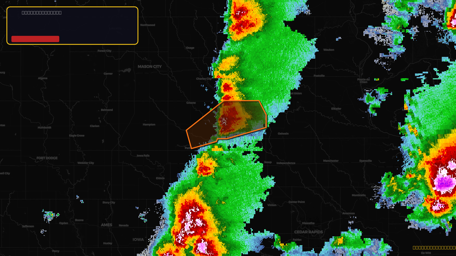
Severe Thunderstorm Warning issued April 17 at 2:35PM CDT until April 17 at 3:15PM CDT by NWS Des Moines IA
Iowa
Pull this lead list →Pre-loads ~7,032 residential properties into Step 2 for zone selection.
✓Counts inside actual storm footprint· 10.1% of NWS polygon hit
Storm Score
52
🏠 Residential
7,032
🏢 Commercial
696
Total properties
7,728
Estimated roofing opportunity🔴 Zones 1 & 2
💰 ~$8.6M
Conservative estimate at 22% claim rate, scoped to the damage zone (core + inner — ~40% of the warning polygon): 🏠 ~2,813 residential · 🏢 ~278 commercial. Industry-low claim values ($10K residential / $40K commercial).
NWS intensity
🧊 1.75"Hail💨 60MPHRadar indicated⚠ ConsiderableIntensity Score 47/100
Issued
Apr 17, 7:35 PM UTC
Expires
Apr 17, 8:15 PM UTC
Event type
Severe Thunderstorm Warning
Affected areas (2)
Bremer, IAButler, IA
ID: urn:oid:2.49.0.1.840.0.3ffc09f2aa611065e65f22ad697a30f776f51575.001.1Centroid: 42.716, -92.448