WatchThunderstorm★ Peak frameCaptured 1d ago
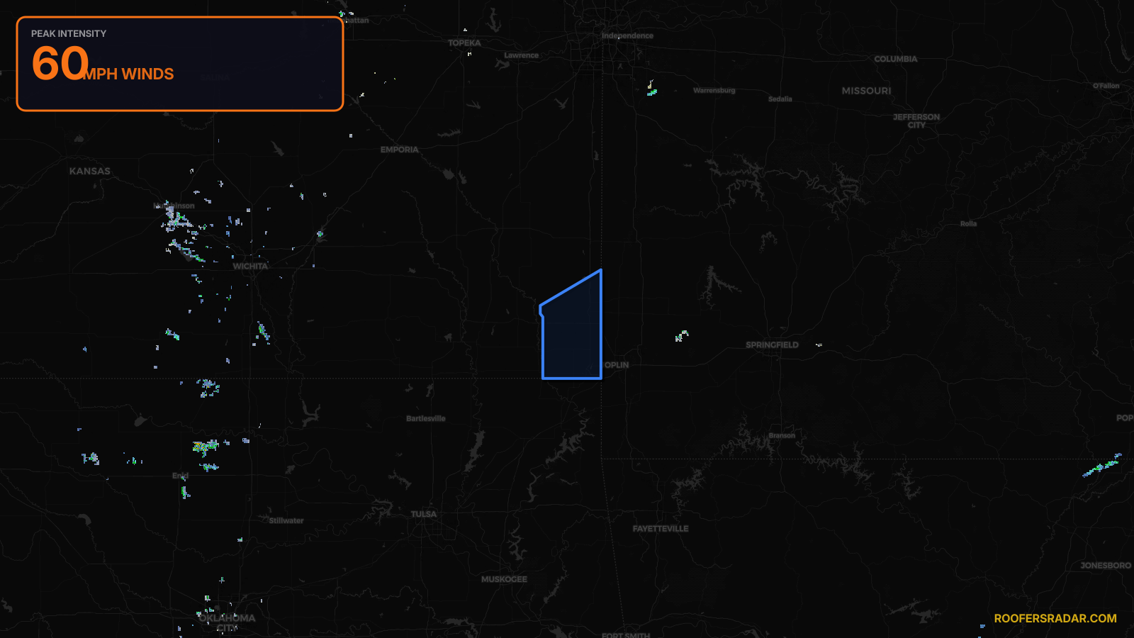
Severe Thunderstorm Warning issued April 17 at 8:57PM CDT until April 17 at 9:45PM CDT by NWS Springfield MO
Kansas
Pull this lead list →Pre-loads ~25,058 residential properties into Step 2 for zone selection.
⚠Counts inside NWS warning area· storm hadn’t entered polygon at capture
Storm Score
9
🏠 Residential
25,058
🏢 Commercial
2,000
Total properties
27,058
NWS intensity
💨 60MPHIntensity Score 9/100
Issued
Apr 18, 1:57 AM UTC
Expires
Apr 18, 2:45 AM UTC
Event type
Severe Thunderstorm Warning
Affected areas (2)
Cherokee, KSCrawford, KS
ID: urn:oid:2.49.0.1.840.0.3f52eee35f4e8a0b58a98062ac0d96bd0ed10eeb.001.1Centroid: 37.367, -94.883