Very SevereThunderstorm★ Peak frameCaptured 2d ago
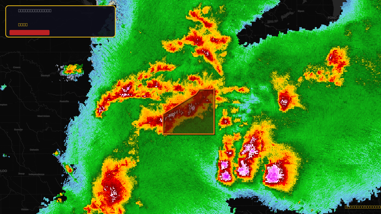
Severe Thunderstorm Warning issued April 17 at 5:09PM CDT until April 17 at 6:00PM CDT by NWS Milwaukee/Sullivan WI
Wisconsin
Pull this lead list →Pre-loads ~4,484 residential properties into Step 2 for zone selection.
✓Counts inside actual storm footprint· 21.5% of NWS polygon hit
Storm Score
38
🏠 Residential
4,484
🏢 Commercial
409
Total properties
4,893
Estimated roofing opportunity🔴 Zones 1 & 2
💰 ~$5.4M
Conservative estimate at 22% claim rate, scoped to the damage zone (core + inner — ~40% of the warning polygon): 🏠 ~1,794 residential · 🏢 ~164 commercial. Industry-low claim values ($10K residential / $40K commercial).
NWS intensity
🧊 1.5"Hail💨 70MPHRadar indicated⚠ ConsiderableIntensity Score 38/100
Issued
Apr 17, 10:09 PM UTC
Expires
Apr 17, 11:00 PM UTC
Event type
Severe Thunderstorm Warning
Affected areas (1)
Iowa, WI
ID: urn:oid:2.49.0.1.840.0.3dd251edd82f76a212ada9edde06f8f32e358867.001.1Centroid: 43.039, -90.111