SevereThunderstorm★ Peak frameCaptured 2d ago
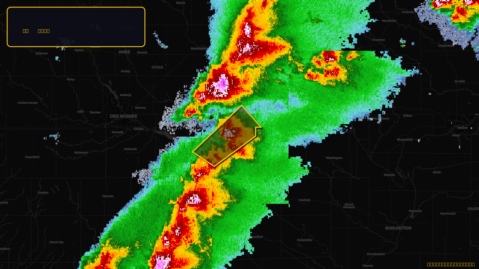
Severe Thunderstorm Warning issued April 17 at 3:10PM CDT until April 17 at 4:00PM CDT by NWS Des Moines IA
Iowa
Pull this lead list →Pre-loads ~1,938 residential properties into Step 2 for zone selection.
✓Counts inside actual storm footprint· 12.9% of NWS polygon hit
Storm Score
13
🏠 Residential
1,938
🏢 Commercial
160
Total properties
2,098
Estimated roofing opportunity🔴 Zones 1 & 2
💰 ~$1.0M
Conservative estimate at 10% claim rate, scoped to the damage zone (core + inner — ~40% of the warning polygon): 🏠 ~775 residential · 🏢 ~64 commercial. Industry-low claim values ($10K residential / $40K commercial).
NWS intensity
🧊 1"Hail💨 60MPHRadar indicatedIntensity Score 13/100
Issued
Apr 17, 8:10 PM UTC
Expires
Apr 17, 9:00 PM UTC
Event type
Severe Thunderstorm Warning
Affected areas (3)
Mahaska, IAMarion, IAPoweshiek, IA
ID: urn:oid:2.49.0.1.840.0.3d6e755ec752e582e28637196ac7219a05c4b429.001.1Centroid: 41.460, -92.559