WatchThunderstorm★ Peak frameCaptured 3d ago
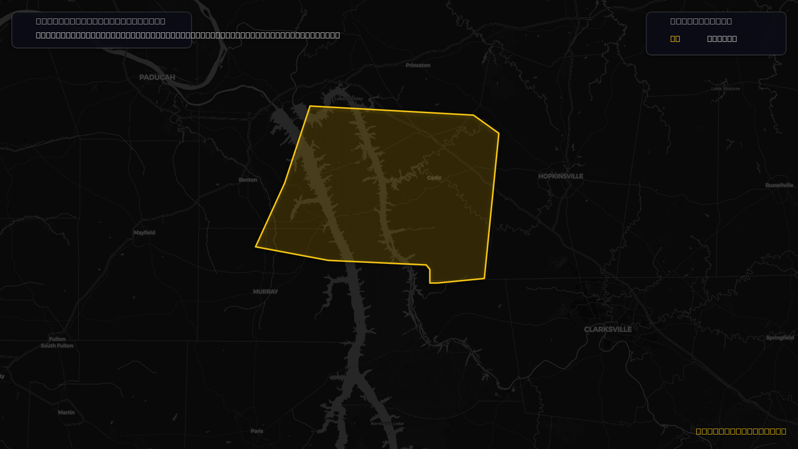
Severe Thunderstorm Warning issued April 16 at 5:26PM CDT until April 16 at 6:30PM CDT by NWS Paducah KY
Kentucky
Pull this lead list →Pre-loads ~12,235 residential properties into Step 2 for zone selection.
Storm Score
8
🏠 Residential
12,235
🏢 Commercial
645
Total properties
12,880
Issued
—
Expires
Apr 16, 11:30 PM UTC
Event type
Severe Thunderstorm Warning
Affected areas (5)
Caldwell, KYCalloway, KYLyon, KYMarshall, KYTrigg, KY
ID: urn:oid:2.49.0.1.840.0.3c125cc63f2b24ff8c6ba7b705d1858ab1052622.001.1Centroid: 36.759, -87.935