SevereThunderstorm★ Peak frameCaptured 2d ago
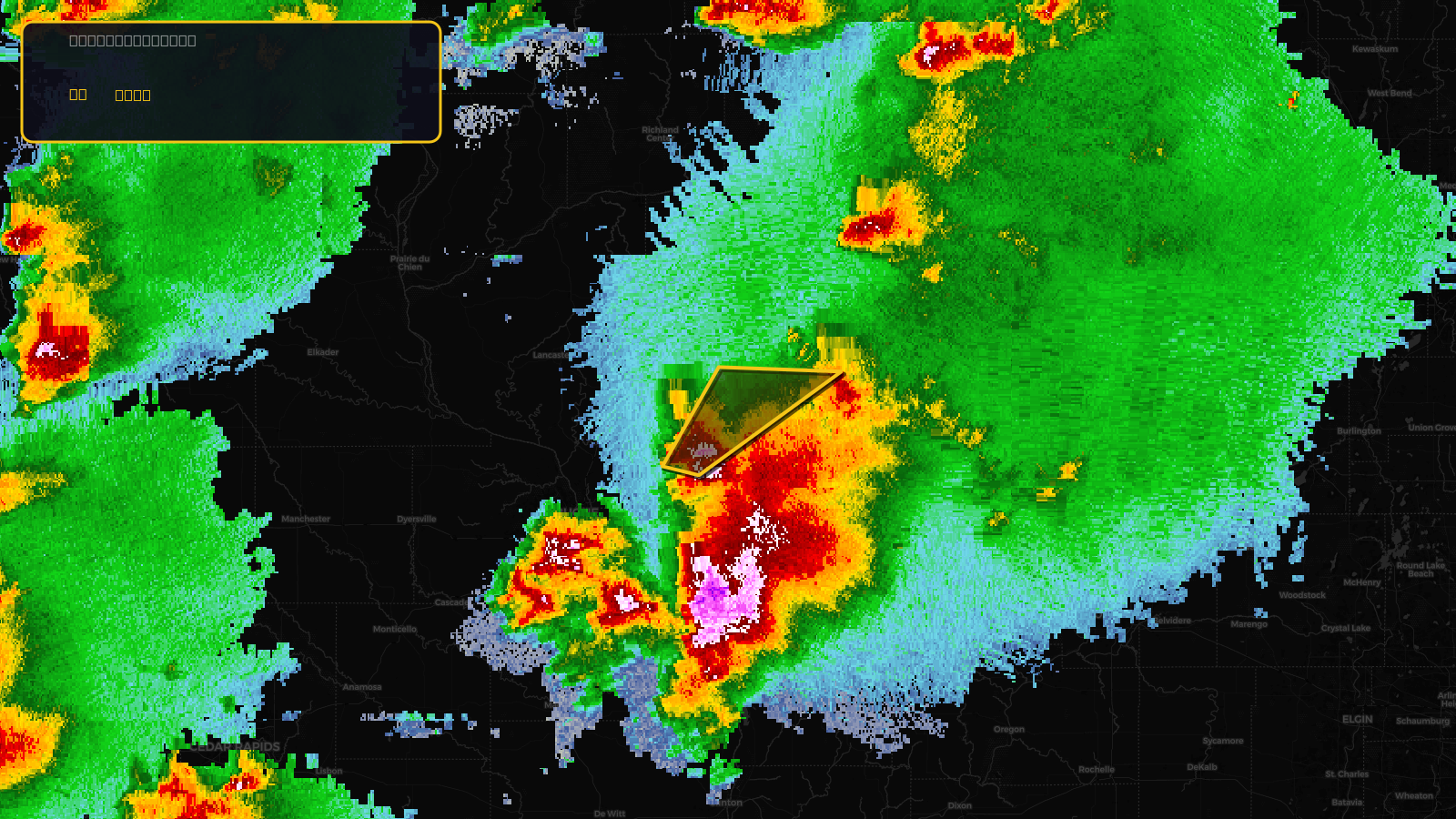
Severe Thunderstorm Warning issued April 17 at 3:12PM CDT until April 17 at 3:45PM CDT by NWS Milwaukee/Sullivan WI
Wisconsin
Pull this lead list →Pre-loads ~1,554 residential properties into Step 2 for zone selection.
✓Counts inside actual storm footprint· 8.5% of NWS polygon hit
Storm Score
10
🏠 Residential
1,554
🏢 Commercial
266
Total properties
1,820
Estimated roofing opportunity🔴 Zones 1 & 2
💰 ~$1.0M
Conservative estimate at 10% claim rate, scoped to the damage zone (core + inner — ~40% of the warning polygon): 🏠 ~622 residential · 🏢 ~106 commercial. Industry-low claim values ($10K residential / $40K commercial).
NWS intensity
🧊 1"HailRadar indicatedIntensity Score 10/100
Issued
Apr 17, 8:12 PM UTC
Expires
Apr 17, 8:45 PM UTC
Event type
Severe Thunderstorm Warning
Affected areas (1)
Lafayette, WI
ID: urn:oid:2.49.0.1.840.0.373ed2b119b2bce27ad1ca3532e60d885d2f4b44.001.1Centroid: 42.726, -90.182