SevereThunderstorm★ Peak frameCaptured 2d ago
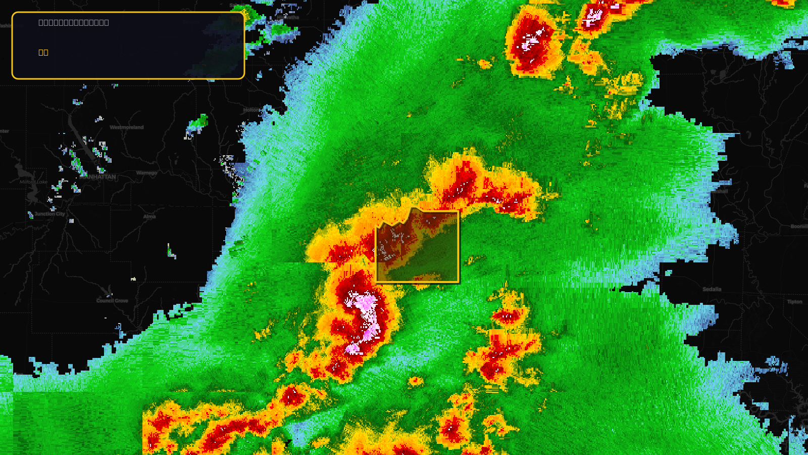
Severe Thunderstorm Warning issued April 17 at 4:27PM CDT until April 17 at 5:15PM CDT by NWS Kansas City/Pleasant Hill MO
Kansas
Pull this lead list →Pre-loads ~161,578 residential properties into Step 2 for zone selection.
✓Counts inside actual storm footprint· 16.2% of NWS polygon hit
Storm Score
13
🏠 Residential
161,578
🏢 Commercial
6,538
Total properties
168,116
Estimated roofing opportunity🔴 Zones 1 & 2
💰 ~$75M
Conservative estimate at 10% claim rate, scoped to the damage zone (core + inner — ~40% of the warning polygon): 🏠 ~64,631 residential · 🏢 ~2,615 commercial. Industry-low claim values ($10K residential / $40K commercial).
NWS intensity
🧊 1"Hail💨 60MPHRadar indicatedIntensity Score 13/100
Issued
Apr 17, 9:27 PM UTC
Expires
Apr 17, 10:15 PM UTC
Event type
Severe Thunderstorm Warning
Affected areas (1)
Johnson, KS
ID: urn:oid:2.49.0.1.840.0.2f47497a17d80fcd4b65fb35235f0ce321d1251f.001.1Centroid: 38.971, -94.905