Very SevereThunderstorm★ Peak frameCaptured 2d ago
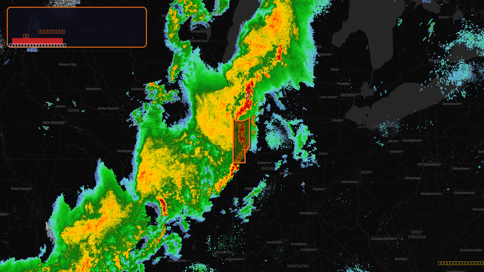
Severe Thunderstorm Warning issued April 17 at 10:01PM CDT until April 17 at 11:15PM CDT by NWS Chicago IL
Indiana
Pull this lead list →Pre-loads ~247,896 residential properties into Step 2 for zone selection.
✓Counts inside actual storm footprint· 9.4% of NWS polygon hit
Storm Score
28
🏠 Residential
247,896
🏢 Commercial
15,005
Total properties
262,901
Estimated roofing opportunity🔴 Zones 1 & 2
💰 ~$271M
Conservative estimate at 22% claim rate, scoped to the damage zone (core + inner — ~40% of the warning polygon): 🏠 ~99,158 residential · 🏢 ~6,002 commercial. Industry-low claim values ($10K residential / $40K commercial).
NWS intensity
💨 70MPH⚠ ConsiderableIntensity Score 28/100
Issued
Apr 18, 3:01 AM UTC
Expires
Apr 18, 4:15 AM UTC
Event type
Severe Thunderstorm Warning
Affected areas (5)
Benton, INJasper, INLake, INNewton, INPorter, IN
ID: urn:oid:2.49.0.1.840.0.2e4194e6f4efbb6e1363687053400673c73703d3.001.1Centroid: 41.216, -87.203