SevereThunderstorm★ Peak frameCaptured 2d ago
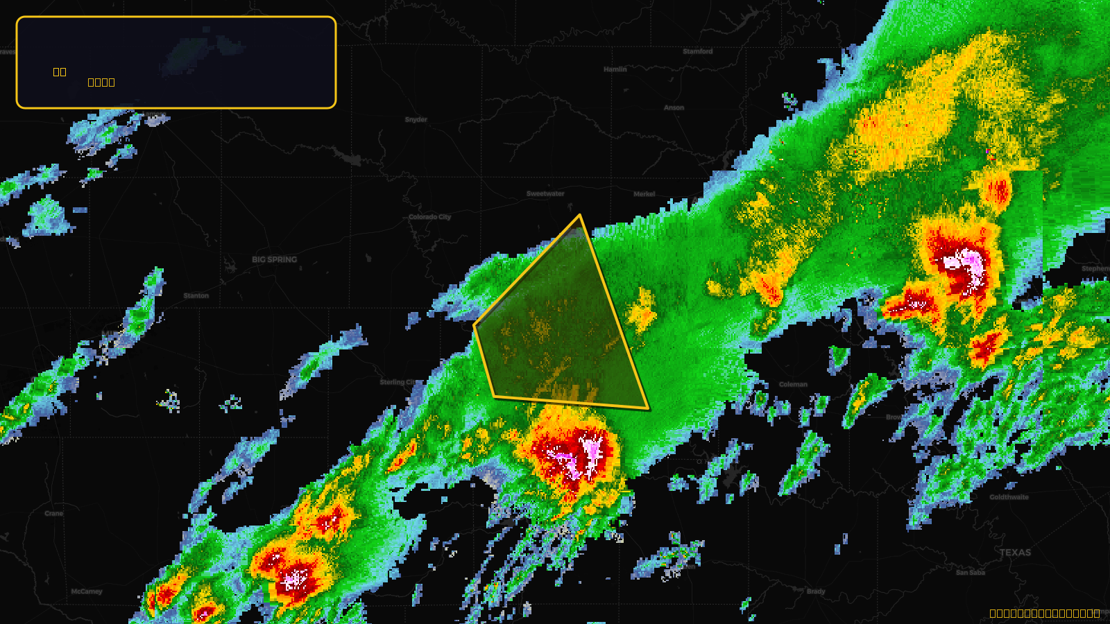
Severe Thunderstorm Warning issued April 18 at 5:45AM CDT until April 18 at 6:30AM CDT by NWS San Angelo TX
Texas
Pull this lead list →Pre-loads ~2,402 residential properties into Step 2 for zone selection.
⚠Counts inside NWS warning area· storm hadn’t entered polygon at capture
Storm Score
11
🏠 Residential
2,402
🏢 Commercial
127
Total properties
2,529
Estimated roofing opportunity🔴 Zones 1 & 2
💰 ~$1.2M
Conservative estimate at 10% claim rate, scoped to the damage zone (core + inner — ~40% of the warning polygon): 🏠 ~961 residential · 🏢 ~51 commercial. Industry-low claim values ($10K residential / $40K commercial).
NWS intensity
🧊 1"Hail💨 60MPHRadar indicatedIntensity Score 11/100
Issued
Apr 18, 10:45 AM UTC
Expires
Apr 18, 11:30 AM UTC
Event type
Severe Thunderstorm Warning
Affected areas (3)
Coke, TXNolan, TXRunnels, TX
ID: urn:oid:2.49.0.1.840.0.2cefac8a44066eda96758231d71a8e664085316f.001.1Centroid: 32.074, -100.368