Very SevereThunderstorm★ Peak frameCaptured 2d ago
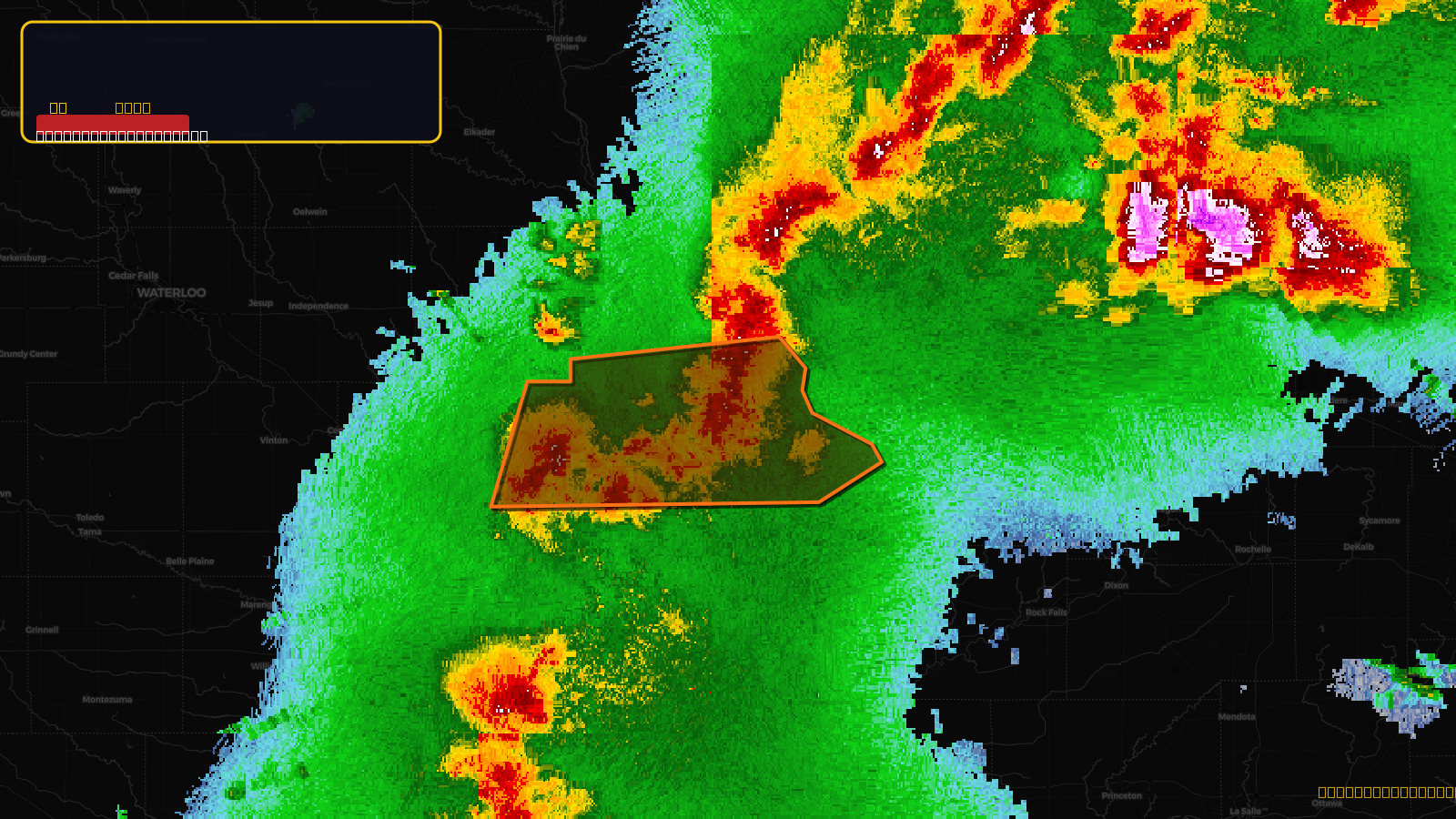
Severe Thunderstorm Warning issued April 17 at 4:48PM CDT until April 17 at 5:45PM CDT by NWS Quad Cities IA IL
Iowa
Pull this lead list →Pre-loads ~10,790 residential properties into Step 2 for zone selection.
✓Counts inside actual storm footprint· 10.5% of NWS polygon hit
Storm Score
31
🏠 Residential
10,790
🏢 Commercial
938
Total properties
11,728
Estimated roofing opportunity🔴 Zones 1 & 2
💰 ~$13M
Conservative estimate at 22% claim rate, scoped to the damage zone (core + inner — ~40% of the warning polygon): 🏠 ~4,316 residential · 🏢 ~375 commercial. Industry-low claim values ($10K residential / $40K commercial).
NWS intensity
🧊 1"Hail💨 70MPHRadar indicated⚠ ConsiderableIntensity Score 31/100
Issued
Apr 17, 9:48 PM UTC
Expires
Apr 17, 10:45 PM UTC
Event type
Severe Thunderstorm Warning
Affected areas (3)
Dubuque, IAJackson, IAJones, IA
ID: urn:oid:2.49.0.1.840.0.2ca530263571549e99b50ad86913fe864cab6bb4.001.1Centroid: 42.238, -90.654