Very SevereThunderstorm★ Peak frameCaptured 2d ago
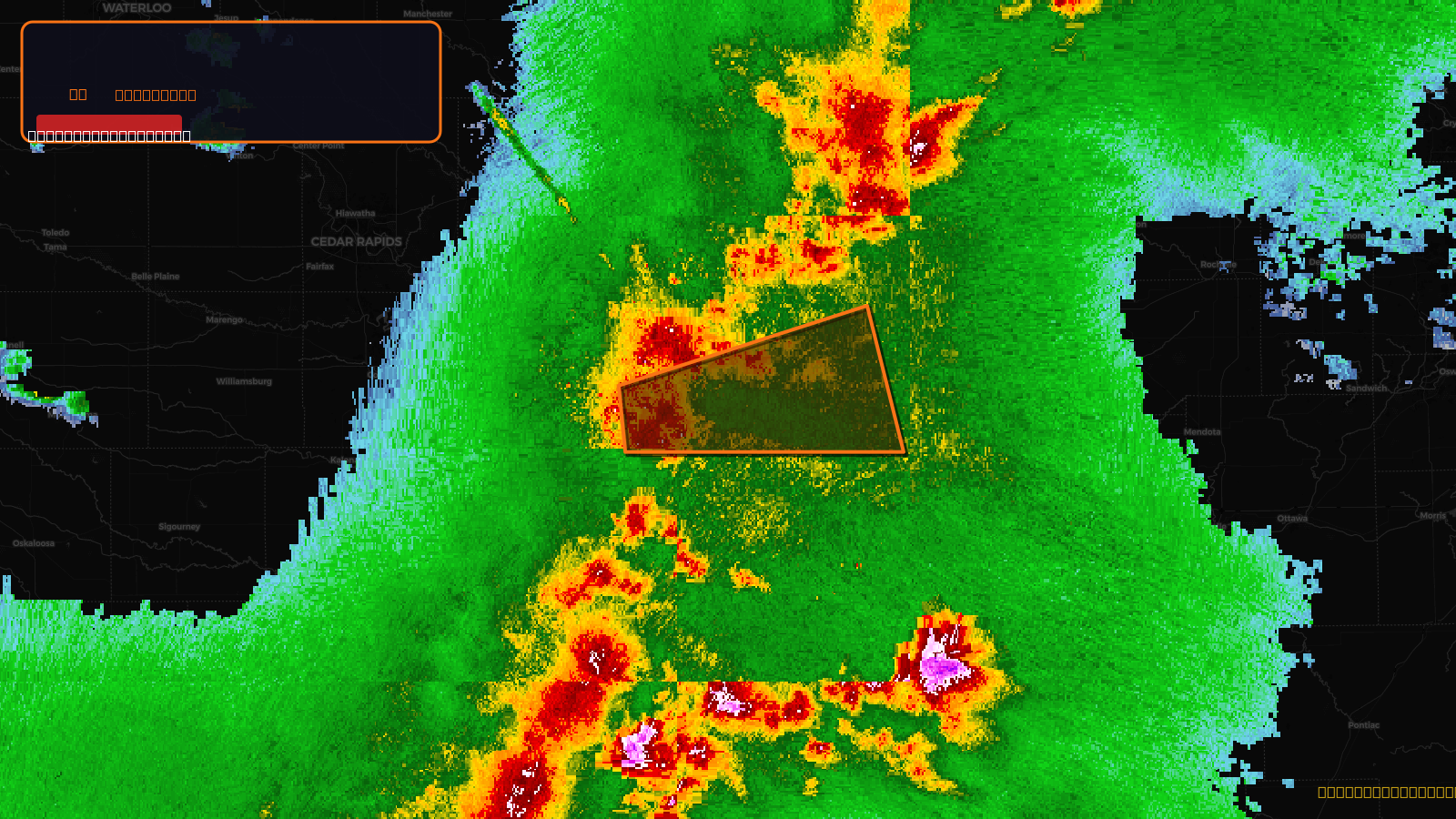
Severe Thunderstorm Warning issued April 17 at 6:06PM CDT until April 17 at 7:00PM CDT by NWS Quad Cities IA IL
Illinois, Iowa
Pull this lead list →Pre-loads ~17,680 residential properties into Step 2 for zone selection.
✓Counts inside actual storm footprint· 8.1% of NWS polygon hit
Storm Score
46
🏠 Residential
17,680
🏢 Commercial
1,040
Total properties
18,720
Estimated roofing opportunity🔴 Zones 1 & 2
💰 ~$19M
Conservative estimate at 22% claim rate, scoped to the damage zone (core + inner — ~40% of the warning polygon): 🏠 ~7,072 residential · 🏢 ~416 commercial. Industry-low claim values ($10K residential / $40K commercial).
NWS intensity
💨 80MPH✓ Wind observed⚠ DestructiveIntensity Score 46/100
Issued
Apr 17, 11:06 PM UTC
Expires
Apr 18, 12:00 AM UTC
Event type
Severe Thunderstorm Warning
Affected areas (6)
Henry, ILRock Island, ILWhiteside, ILClinton, IAMuscatine, IAScott, IA
ID: urn:oid:2.49.0.1.840.0.2b8481e8f9fdd5defa9f85e1be04d638f940402b.001.1Centroid: 41.596, -90.550