SevereThunderstorm★ Peak frameCaptured 2d ago
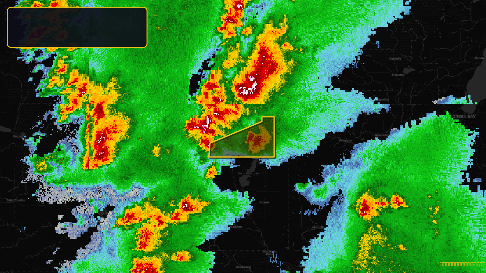
Severe Thunderstorm Warning issued April 17 at 3:27PM CDT until April 17 at 4:15PM CDT by NWS Green Bay WI
Wisconsin
Pull this lead list →Pre-loads ~4,261 residential properties into Step 2 for zone selection.
✓Counts inside actual storm footprint· 5.2% of NWS polygon hit
Storm Score
13
🏠 Residential
4,261
🏢 Commercial
214
Total properties
4,475
Estimated roofing opportunity🔴 Zones 1 & 2
💰 ~$2.0M
Conservative estimate at 10% claim rate, scoped to the damage zone (core + inner — ~40% of the warning polygon): 🏠 ~1,704 residential · 🏢 ~86 commercial. Industry-low claim values ($10K residential / $40K commercial).
NWS intensity
🧊 1"Hail💨 60MPHRadar indicatedIntensity Score 13/100
Issued
Apr 17, 8:27 PM UTC
Expires
Apr 17, 9:15 PM UTC
Event type
Severe Thunderstorm Warning
Affected areas (1)
Wood, WI
ID: urn:oid:2.49.0.1.840.0.29e0e0fe7d50e18f0a08cb1a8614339f0f49ef1e.001.1Centroid: 44.383, -90.011