SevereThunderstorm★ Peak frameCaptured 2d ago
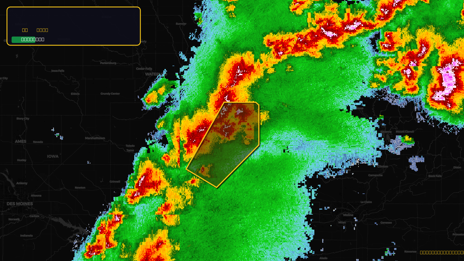
Severe Thunderstorm Warning issued April 17 at 3:24PM CDT until April 17 at 4:30PM CDT by NWS Quad Cities IA IL
Iowa
Pull this lead list →Pre-loads ~86,885 residential properties into Step 2 for zone selection.
✓Counts inside actual storm footprint· 12.4% of NWS polygon hit
Storm Score
15
🏠 Residential
86,885
🏢 Commercial
6,525
Total properties
93,410
Estimated roofing opportunity🔴 Zones 1 & 2
💰 ~$45M
Conservative estimate at 10% claim rate, scoped to the damage zone (core + inner — ~40% of the warning polygon): 🏠 ~34,754 residential · 🏢 ~2,610 commercial. Industry-low claim values ($10K residential / $40K commercial).
NWS intensity
🧊 1"Hail✓ Observed (ground-truth)Intensity Score 15/100
Issued
Apr 17, 8:24 PM UTC
Expires
Apr 17, 9:30 PM UTC
Event type
Severe Thunderstorm Warning
Affected areas (4)
Benton, IAIowa, IAJohnson, IALinn, IA
ID: urn:oid:2.49.0.1.840.0.292aabfb6e65fcffa63964896b8d28e92b5e70d0.001.1Centroid: 42.101, -91.614