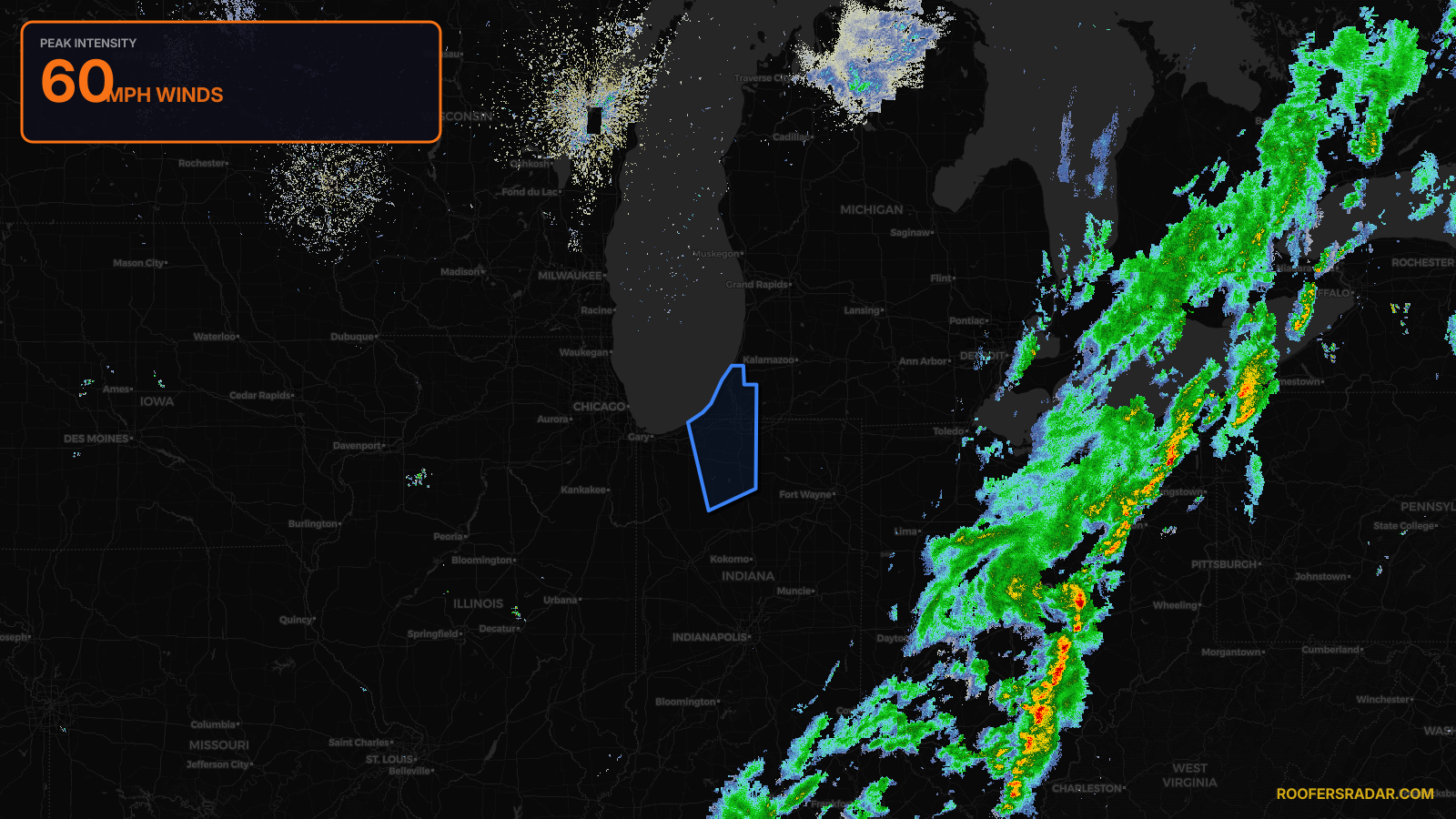
WatchThunderstorm★ Peak frameCaptured 1d ago
Severe Thunderstorm Warning issued April 18 at 12:26AM EDT until April 18 at 1:30AM EDT by NWS Northern Indiana
Indiana, Michigan
Pull this lead list →Pre-loads ~251,302 residential properties into Step 2 for zone selection.
⚠Counts inside NWS warning area· storm hadn’t entered polygon at capture
Storm Score
9
🏠 Residential
251,302
🏢 Commercial
16,684
Total properties
267,986
NWS intensity
💨 60MPHIntensity Score 9/100
Issued
Apr 18, 4:26 AM UTC
Expires
Apr 18, 5:30 AM UTC
Event type
Severe Thunderstorm Warning
Affected areas (8)
Fulton, INLa Porte, INMarshall, INPulaski, INSt. Joseph, INStarke, INBerrien, MICass, MI
ID: urn:oid:2.49.0.1.840.0.1f2914b25311faa1dec3f0ea7ca2b94d5a7da32d.001.1Centroid: 41.846, -86.415