SevereTornado★ Peak frameCaptured 2d ago
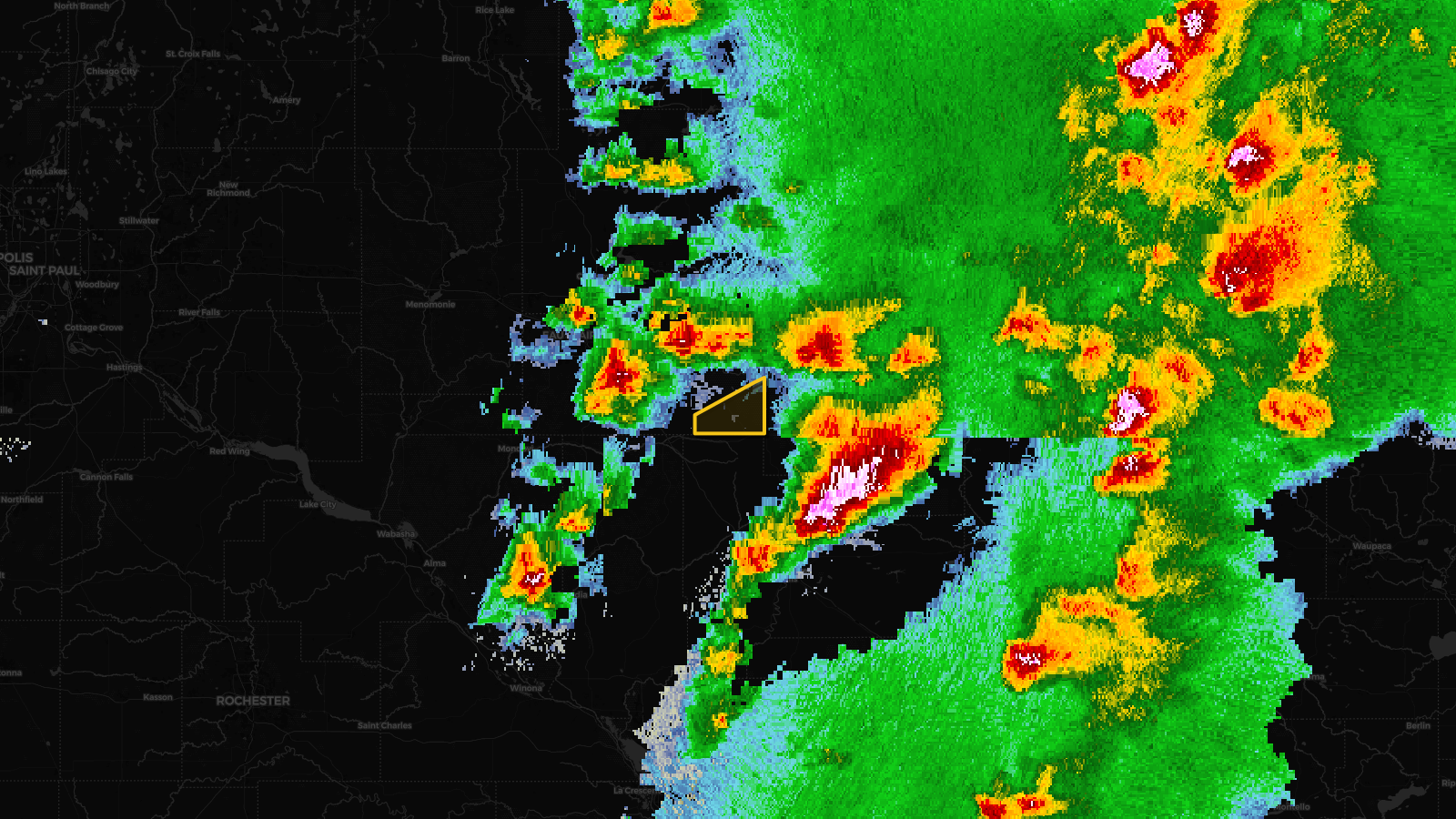
Tornado Warning issued April 17 at 4:44PM CDT until April 17 at 4:45PM CDT by NWS Twin Cities/Chanhassen MN
Wisconsin
Pull this lead list →Pre-loads ~366 residential properties into Step 2 for zone selection.
⚠Counts inside NWS warning area· storm hadn’t entered polygon at capture
Storm Score
20
🏠 Residential
366
🏢 Commercial
38
Total properties
404
Estimated roofing opportunity🔴 Zones 1 & 2
💰 ~$206K
Conservative estimate at 10% claim rate, scoped to the damage zone (core + inner — ~40% of the warning polygon): 🏠 ~146 residential · 🏢 ~15 commercial. Industry-low claim values ($10K residential / $40K commercial).
Issued
Apr 17, 9:44 PM UTC
Expires
Apr 17, 9:54 PM UTC
Event type
Tornado Warning
Affected areas (1)
Eau Claire, WI
ID: urn:oid:2.49.0.1.840.0.1d351c10a23a10a0c51abb251ae33e92bd90e621.001.1Centroid: 44.652, -91.030