SevereThunderstorm★ Peak frameCaptured 2d ago
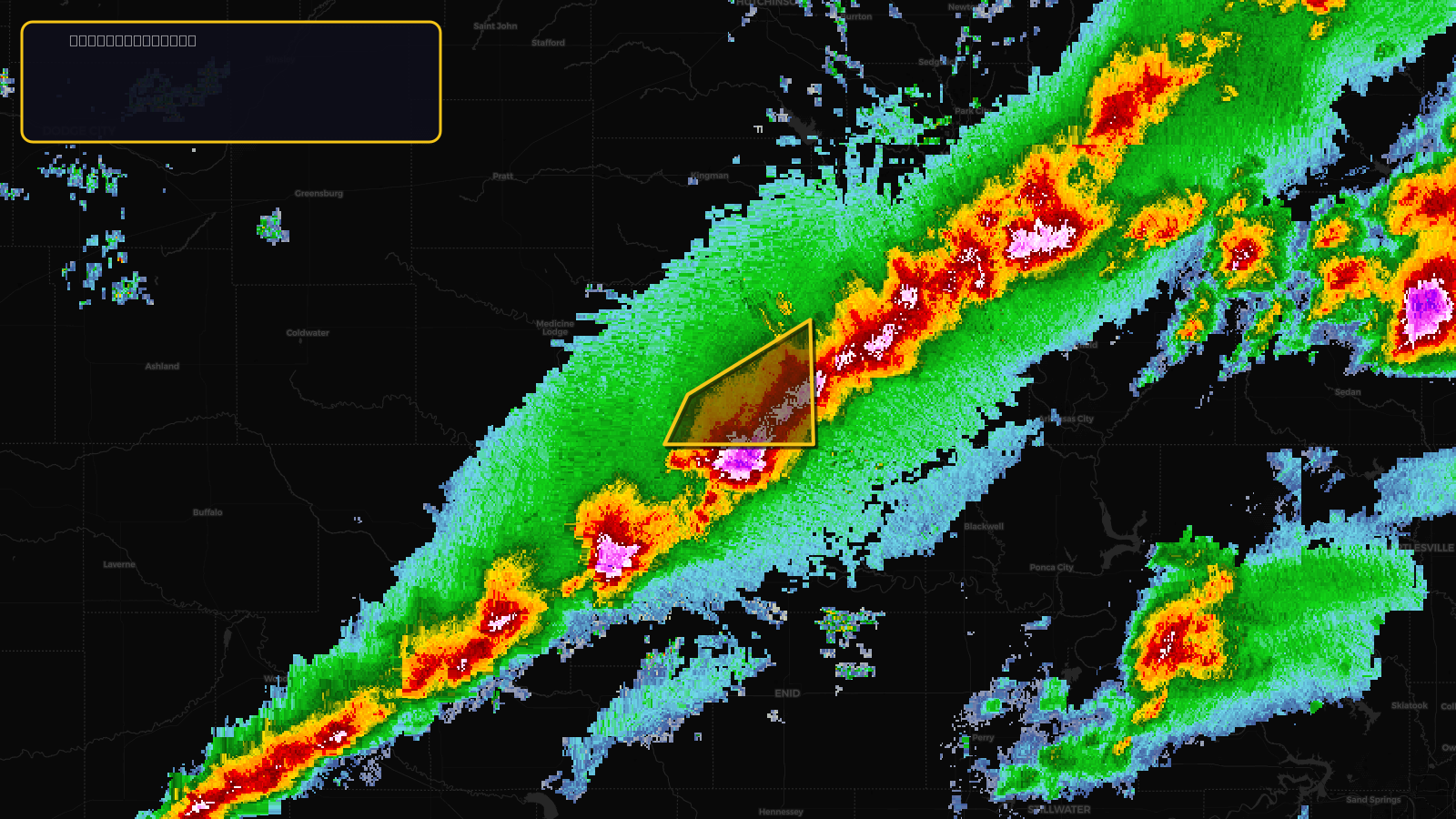
Severe Thunderstorm Warning issued April 17 at 3:27PM CDT until April 17 at 4:30PM CDT by NWS Wichita KS
Kansas
Pull this lead list →Pre-loads ~1,341 residential properties into Step 2 for zone selection.
✓Counts inside actual storm footprint· 16.7% of NWS polygon hit
Storm Score
13
🏠 Residential
1,341
🏢 Commercial
182
Total properties
1,523
Estimated roofing opportunity🔴 Zones 1 & 2
💰 ~$828K
Conservative estimate at 10% claim rate, scoped to the damage zone (core + inner — ~40% of the warning polygon): 🏠 ~536 residential · 🏢 ~73 commercial. Industry-low claim values ($10K residential / $40K commercial).
NWS intensity
🧊 1"Hail💨 60MPHRadar indicatedIntensity Score 13/100
Issued
Apr 17, 8:27 PM UTC
Expires
Apr 17, 9:30 PM UTC
Event type
Severe Thunderstorm Warning
Affected areas (1)
Harper, KS
ID: urn:oid:2.49.0.1.840.0.100f0b15ba773de87e76e6145b52be9ab50abd46.001.1Centroid: 37.084, -98.058