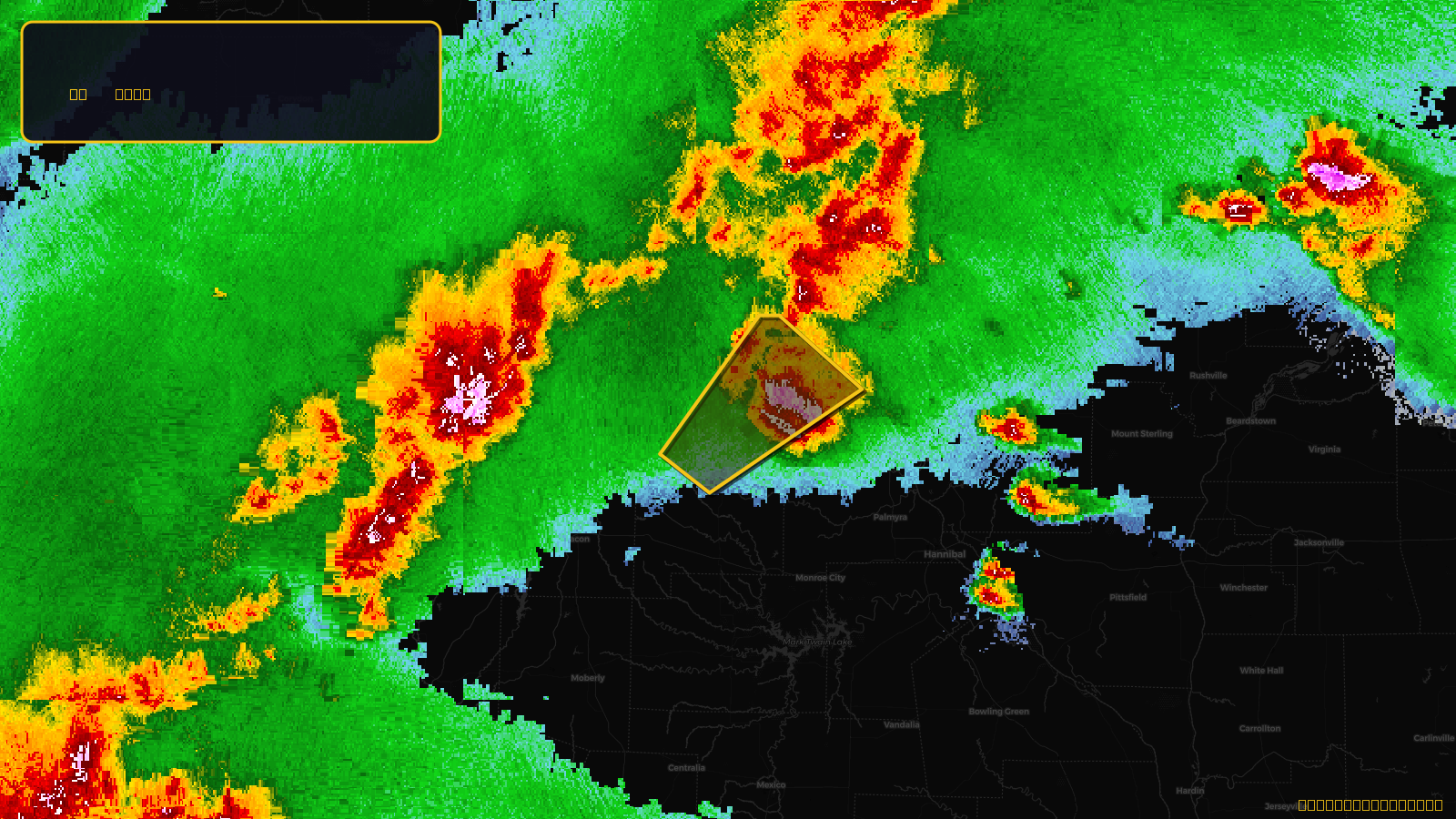
SevereTornado★ Peak frameCaptured 2d ago
Tornado Warning issued April 17 at 5:03PM CDT until April 17 at 5:45PM CDT by NWS St Louis MO
Missouri
Pull this lead list →Pre-loads ~1,781 residential properties into Step 2 for zone selection.
✓Counts inside actual storm footprint· 9.7% of NWS polygon hit
Storm Score
23
🏠 Residential
1,781
🏢 Commercial
104
Total properties
1,885
Estimated roofing opportunity🔴 Zones 1 & 2
💰 ~$880K
Conservative estimate at 10% claim rate, scoped to the damage zone (core + inner — ~40% of the warning polygon): 🏠 ~712 residential · 🏢 ~42 commercial. Industry-low claim values ($10K residential / $40K commercial).
NWS intensity
🧊 1"HailIntensity Score 23/100
Issued
Apr 17, 10:03 PM UTC
Expires
Apr 17, 10:45 PM UTC
Event type
Tornado Warning
Affected areas (3)
Knox, MOLewis, MOShelby, MO
ID: urn:oid:2.49.0.1.840.0.0f6e726a5e021397d59e1ac7b6dd224811056989.001.1Centroid: 40.043, -92.014