Very SevereThunderstorm★ Peak frameCaptured 2d ago
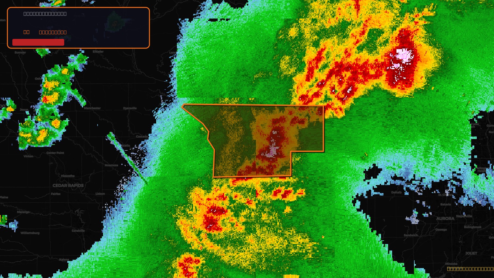
Severe Thunderstorm Warning issued April 17 at 5:30PM CDT until April 17 at 6:45PM CDT by NWS Quad Cities IA IL
Illinois, Iowa
Pull this lead list →Pre-loads ~37,240 residential properties into Step 2 for zone selection.
✓Counts inside actual storm footprint· 8.9% of NWS polygon hit
Storm Score
28
🏠 Residential
37,240
🏢 Commercial
2,861
Total properties
40,101
Estimated roofing opportunity🔴 Zones 1 & 2
💰 ~$43M
Conservative estimate at 22% claim rate, scoped to the damage zone (core + inner — ~40% of the warning polygon): 🏠 ~14,896 residential · 🏢 ~1,144 commercial. Industry-low claim values ($10K residential / $40K commercial).
NWS intensity
💨 70MPH✓ Wind observed⚠ ConsiderableIntensity Score 28/100
Issued
Apr 17, 10:30 PM UTC
Expires
Apr 17, 11:45 PM UTC
Event type
Severe Thunderstorm Warning
Affected areas (4)
Carroll, ILJo Daviess, ILStephenson, ILJackson, IA
ID: urn:oid:2.49.0.1.840.0.0cccbc56bf2e2ddbaa5dfea162ba874890360dad.001.1Centroid: 42.281, -90.079