Very SevereThunderstorm★ Peak frameCaptured 2d ago
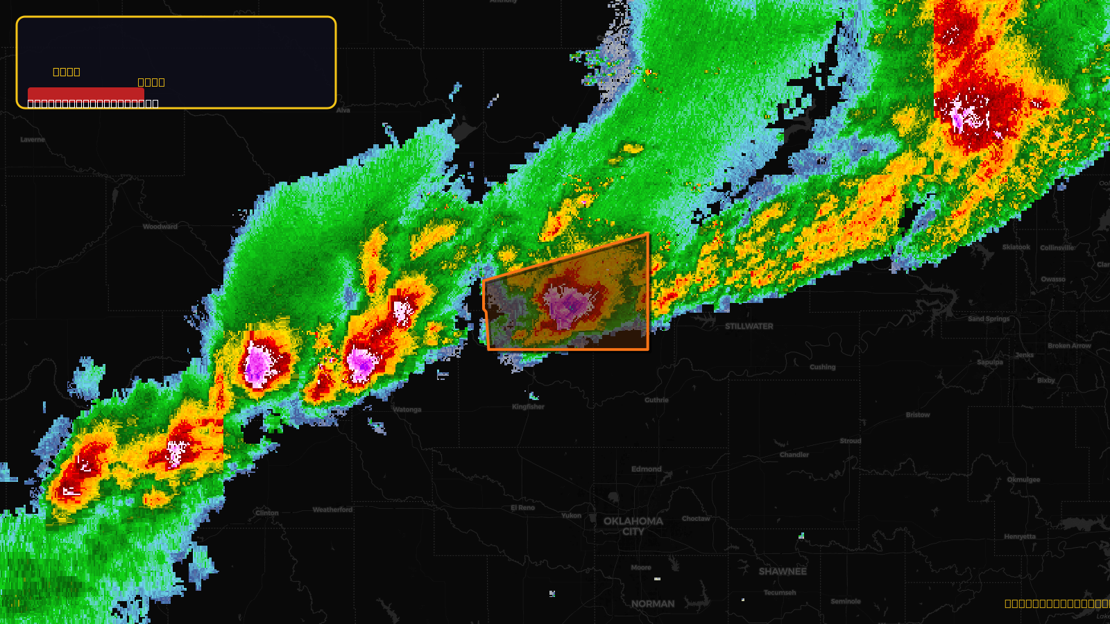
Severe Thunderstorm Warning issued April 17 at 7:35PM CDT until April 17 at 8:15PM CDT by NWS Norman OK
Oklahoma
Pull this lead list →Pre-loads ~2,722 residential properties into Step 2 for zone selection.
✓Counts inside actual storm footprint· 10.9% of NWS polygon hit
Storm Score
48
🏠 Residential
2,722
🏢 Commercial
241
Total properties
2,963
Estimated roofing opportunity🔴 Zones 1 & 2
💰 ~$3.2M
Conservative estimate at 22% claim rate, scoped to the damage zone (core + inner — ~40% of the warning polygon): 🏠 ~1,089 residential · 🏢 ~96 commercial. Industry-low claim values ($10K residential / $40K commercial).
NWS intensity
🧊 2.5"Hail💨 60MPHRadar indicated⚠ ConsiderableIntensity Score 48/100
Issued
Apr 18, 12:35 AM UTC
Expires
Apr 18, 1:15 AM UTC
Event type
Severe Thunderstorm Warning
Affected areas (3)
Garfield, OKKingfisher, OKLogan, OK
ID: urn:oid:2.49.0.1.840.0.00d29312654cb5ddc1989a734d3084a8278b8940.001.1Centroid: 36.160, -97.827